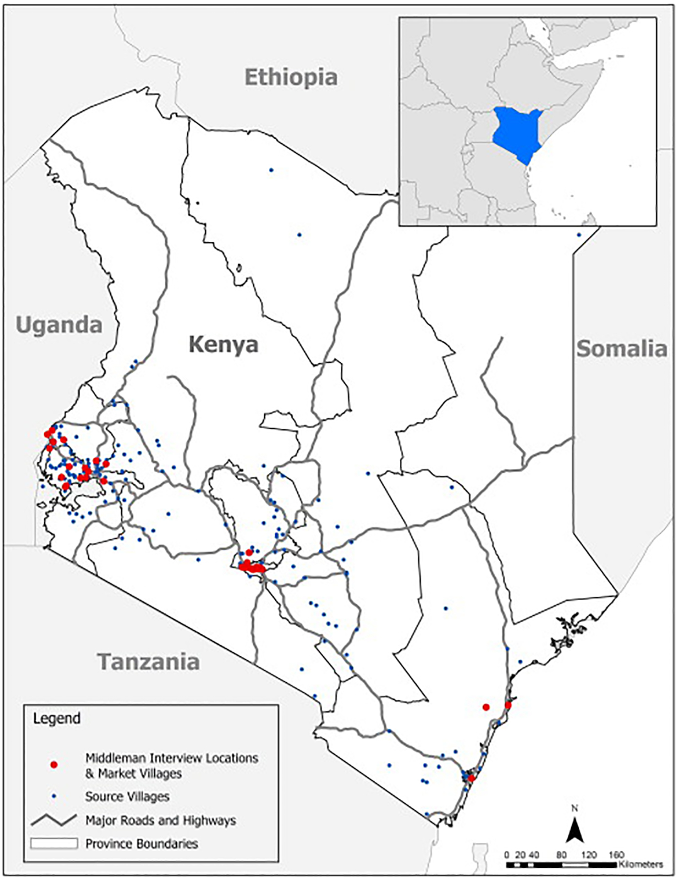
Fig. 1.

Survey locations, major markets surveyed, and common bird collection villages, Kenya, 2008. The figure is a map of Kenya with symbols for survey locations; poultry source villages, major roads and highways, and provincial boundaries. A large red circle indicates villages where markets are located. These villages and markets are locations where middlemen were interviewed. A small blue circle represents the source villages – those villages where middlemen purchased poultry from backyard farmers and other traders. A zig-zag black line depicts major roads and highways across the country. A small white rectangle portrays the color used for the body of the map, with a dark gray border which depicts the province boundaries. The country name and the names of those countries neighboring Kenya are included on the map.
