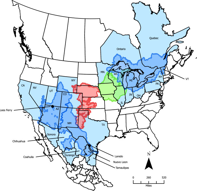
Fig. 1. Map of central North America identifying transboundary basins (dark blue) of the Colorado River, the Rio Grande, and the Laurentian Great Lakes; states and provinces (light blue) within the US, Mexico, and Canada intersecting these basins; and the areal extent of both the Ogallala (red) and Cambrian-Ordovician (green) aquifers.
Locations of the Lees Ferry (AZ) and Laredo (TX) flow monitoring stations (see Fig. 2) are also shown. North American political boundaries were obtained from: the Commission for Environmental Cooperation (CEC). 2021. “North American Atlas—Political Boundaries”. Statistics Canada, United States Census Bureau, Instituto Nacional de Estadística y Geografía (INEGI). Available at www.cec.org/north-american-environmental-atlas/political-boundaries-2021/.

