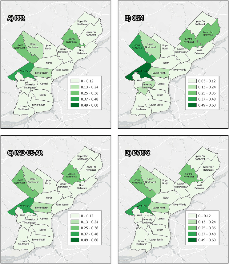
Map. 2.
Philadephia planning districts. Panels display Philadelphia planning districts, symbolized by the proportion of area of each district that is categorized as greenspace or parkland by four different sources of data: the Philadelphia Parks and Recreation Department, Open Street Maps, PAD-US-AR, and the Delaware Valley Regional Planning Commission. Individual districts may fall into different categories of park/greenspace density depending on the source of data used, because different data sources delineate different boundaries and have different eligible properties. For example, the Lower southwest contains the John Heinz National Wildlife Refuge, which is included in all sources of data except PPR

