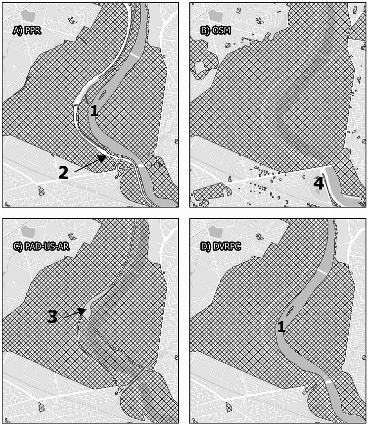
Map. 3.
Fairmount Park. Panels display the area surrounding Fairmount Park, comparing map data from the Philadelphia Parks and Recreation Department, Open Street Maps, PAD-US-AR, and the Delaware Vally Regional Planning Commission. While all maps display similar boundaries for Fairmount Park itself, smaller park areas within the larger park are treated differently. While PPR and DVRPC exclude the Schuylkill River from the boundaries of the park (1), Open Street Maps and PAD-US-AR includes the river. Only PPR excludes Interstate 76 from the park features (2), including as parkland only pedestrian-accessible underpasses. Only PAD-US-AR excludes rain infrastructure from the park features (3). No data excludes local roads from park features, although this area includes large and heavily-trafficked roadways such as Belmont and Montgomery Avenues to the west and Kelley Drive to the east. All maps other than OSM include the Philadelphia Zoo (4)

