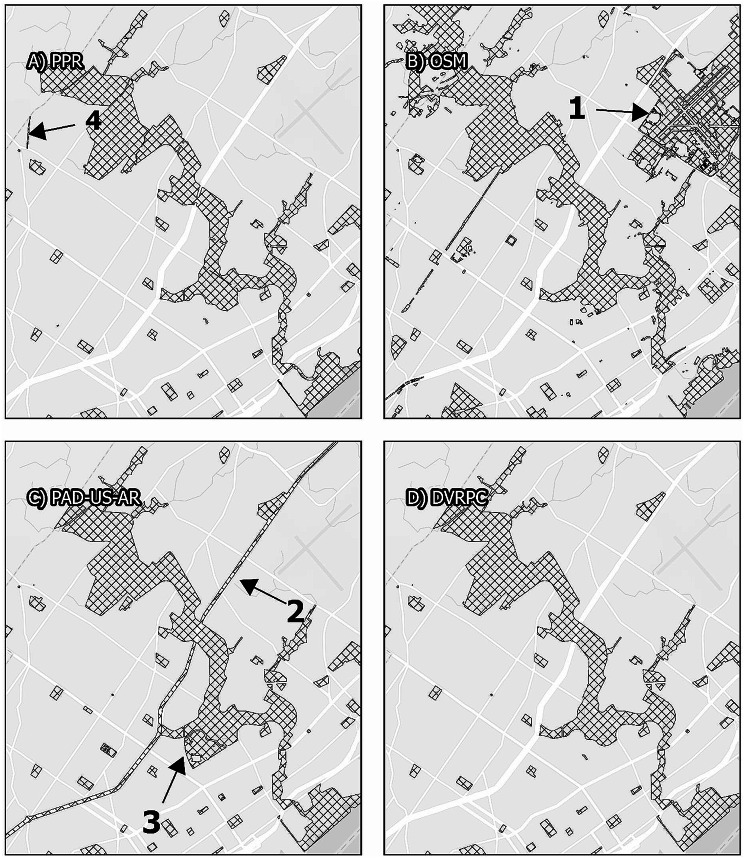
Map. 4.
Pennypack Park and surroundings. Panels display the area surrounding Pennypack Philadelphia, comparing map data from the Philadelphia Parks and Recreation Department, Open Street Maps, PAD-US-AR, and the Delaware Vally Regional Planning Commission. While all maps display similar boundaries for Pennypack Park itself, Open Street Maps includes fields between runways of the Northeast Philadelphia Airport as grassland (1), and PAD-US-AR operationalizes the median of an urban highway (2). PAD-US-AR is also the only data source that includes the entirety of the Abraham Lincoln High School campus as a park (3). PPR is the only data source to include the Lorimer Trail Greenway (4)

