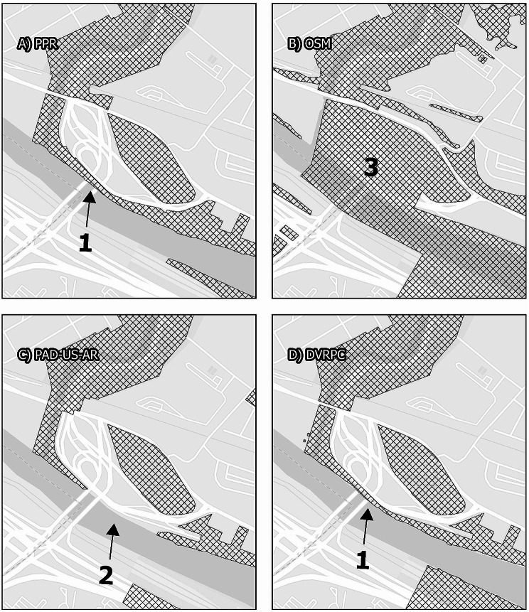
Map. 5.
Schuylkill River Trail. The Schuylkill River Trail is a linear park that forms a substantial component of Philadelphia’s park infrastructure, and that in some places proves difficult to represent in mapped data. These panels display the area where the Schuylkill River Trail, alone the northeastern bank of the Schuylkill River, passes underneath US-1. In data from the Philadelphia Parks and Recreation Department and the Delaware Valley Regional Planning commission, this is represented as a thin feature along the riverbank that intersects the highway (1). In contract, PAD-US-AR excludes the entire highway interchange (2), despite the fact that there is parkland underneath it, and Open Street Maps includes the entire area as a continuous feature (3), although some areas are inaccessible due to the highway infrastructure

