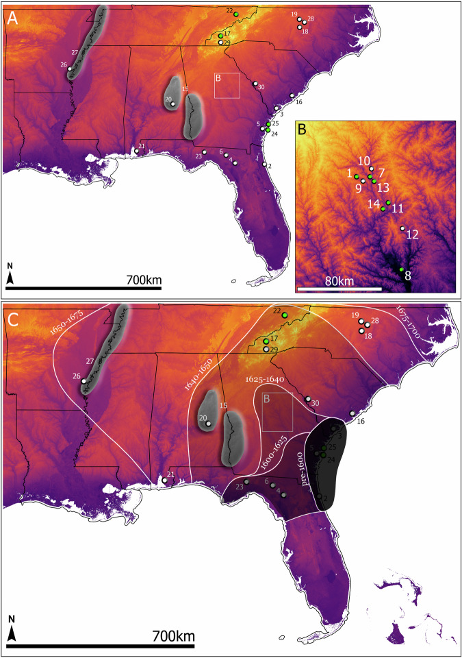
Fig. 1. Spatial distribution of AMS, archeological, and ethnohistoric data.
A Map of archeological sites pre-dating the 18th century that have yielded charred or preserved peach pits, sites from which peach pits have been directly dated via AMS, and areas or sub-regions where archeological evidence for peaches is limited but can be understood from ethnohistoric accounts. Information on numbered sites is presented in Supplemental Data 1 of the Supplementary Information. B Expanded map of Oconee Valley. C Hypothesized spread of peaches across the American Southeast. A table of site names and information along with all AMS, archeological, and ethnohistoric data and information for each individual site used to create the dispersal model are all included as Supplemental Data 1. Basemap of elevation data was downloaded from the publicly available USGS National Map (https://www.usgs.gov/the-national-map-data-delivery).

