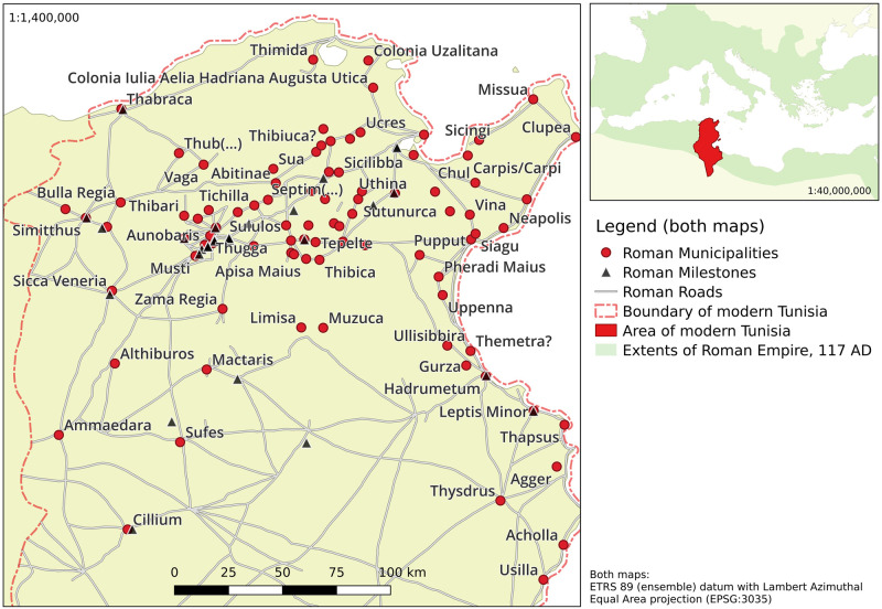
Fig 1. Location of area of interest (smaller map) and geographical distributions of selected municipalities and milestones used in this study, along with Roman road network.
See sections 2.3 and S1 Appendix 4 for details. Third party data sources: Background topography by Natural Earth Project [59] (public domain); Roman roads network lines reproduced with permission from Ancient World Mapping Center [60] under a CC BY licence, original copyright 2015.

