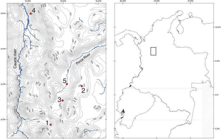
Figure 1. Map of the northern section of the Cordillera Central in Colombia showing the localities of our fieldwork.
Map made by the authors, using the QGIS program (https://www.qgis.org/en/site/index.html) and spatial data from DIVA-GIS (http://diva-gis.org/). Both repositories are Free and Open Source Geographic Information System.

