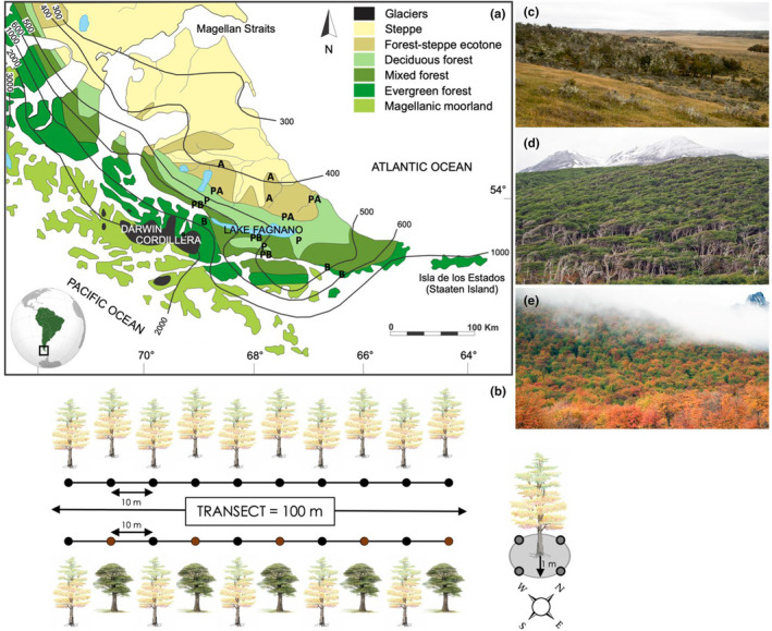
FIGURE 1.

(a) Vegetation map of Tierra del Fuego (modified from Musotto et al., 2017, used with permission) with mean annual precipitation isohyets and sampling plots indicated with letters: A = N. antarctica, B = N. betuloides, P = N. pumilio, PA = mixed pumilio‐antarctica, PB = mixed pumilio‐betuloides. (b) Sampling scheme in monodominant and mixed forests along a 100 m transect; for each sample, four soil cores were collected beneath each focal tree in cardinal directions. (c) Deciduous N. antarctica forest in the ecotone with the Patagonian steppe in the northern part of Tierra del Fuego. (d) Evergreen N. betuloides forest along the coast of the Beagle channel. (e) Deciduous N. pumilio forest along mountain slopes of the Andes cordillera in falls.
