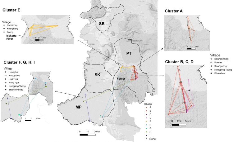
Fig 3. Spatial distribution of genomic clusters.
Malaria cases were identified in four districts: Pathoomphone (PT), Moonlapamok (MP), Sanasomboon (SB), and Sukhuma (SK). The dots on the map represent the locations where clustered cases were collected, while the diamonds indicate the residential villages from which they originated. Clusters A, B, C, and D are concentrated in the eastern region of the Pathoomphone district, near the fringes of the forest. Cluster E is situated in the western part of the Pathoomphone district, close to the Mekong River. Four smaller clusters F, G, H, and I were identified between the Moonlapamok and Pathoomphone. The base layer of the map is accessed from the Humanitarian Data Exchange (HDX), an open data sharing platform managed by the United Nations Office for the Coordination of Humanitarian Affairs [26].

