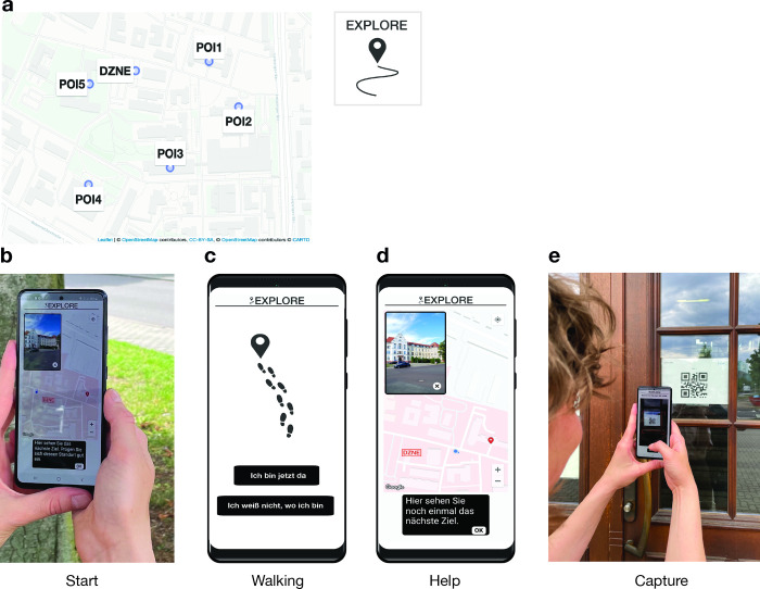
Fig 1. Mobile wayfinding task implemented in the “Explore” app.
(a) Starting from the DZNE, participants had to find five points-of-interest (POIs) on the surrounding campus area. Base map data is copyrighted to OpenStreetMap contributors under the Open Database License (https://www.openstreetmap.org/copyright/en). Base map style is copyrighted to Carto (www.carto.com) under a CC-BY 4.0 license (https://github.com/CartoDB/basemap-styles/blob/master/LICENSE.md). (b) For each POI, a map was displayed at the start of the track, showing the current location of the participant and the POI location as well as a picture of the POI (start phase). (c) During walking, the map was not shown (walking phase). (d) If needed, participants could view the map again by calling the help function (help phase). (e) A track was successfully completed when a QR code, which was placed at the entrance door of the POI, was scanned with the phone camera (capture phase). The phone mockup in Fig 1C–1D was designed by Freepik (http://www.freepik.com).

