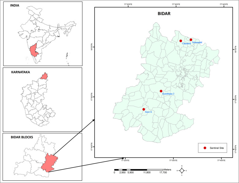
Fig 1. Map showing the sentinel sites selected for the study in Bidar district of Karnataka, India.
Base layer of map: https://onlinemaps.surveyofindia.gov.in. License information: https://onlinemaps.surveyofindia.gov.in/GeospatialGuidelines.aspx. ArcGIS Software: https://www.arcgis.com.

