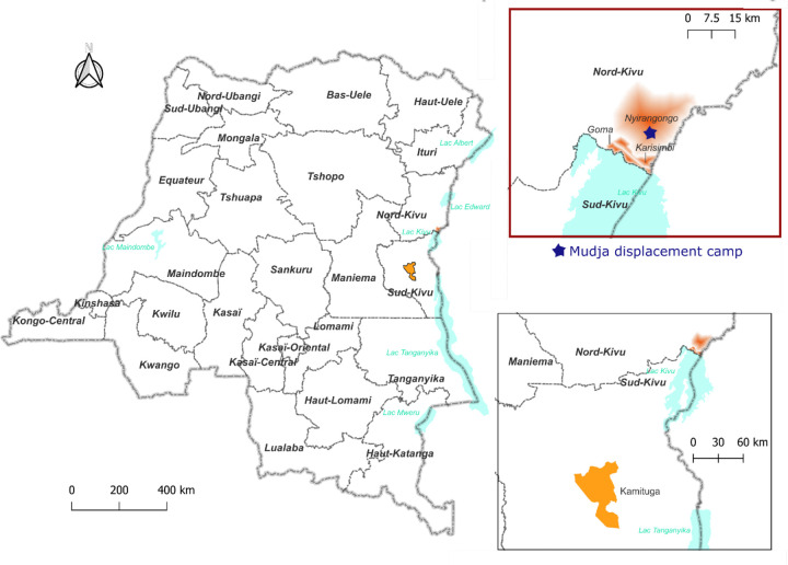
Figure 1: Geographic locations of cases identified in North Kivu including Mudja displacement camp.
Map constructed using QGIS3.22.11. The fading red coloring on the inset signifies the three Goma health zones where the sequenced samples originated from. The star representing Mudja (or Muja) camp location within Nyiragongo health zone utilizing coordinates from Google maps and OpenStreetMap.

