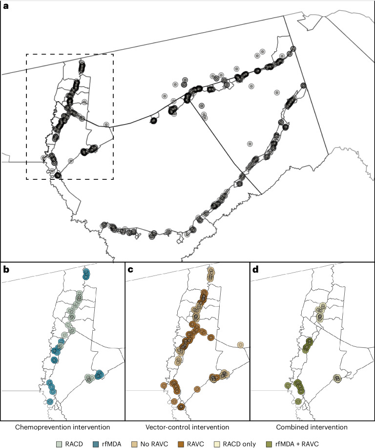
Fig. 1. Map of target areas and spillover zones in the study site.
a, All index cases during the study period. Black lines indicate borders of enumeration areas. The centroid of each circle is the residence location of a treated index case. Inner circles indicate 500-m target areas where interventions were delivered. Outer circles indicate the 1-km radius around each index case in which spillover effects were estimated in the primary analyses. Index-case locations were clustered along major roads, where the majority of households were located in the study site. The dashed line encloses the region shown in b–d, showing index cases during the follow-up periods with the largest number of treated index cases. b–d, Examples of analytic cohorts from a single follow-up period (that is, subsample of person-time) in a subset of the study area for each comparison of study arms. b, Index cases in the RACD and rfMDA arms are shown (5-week period, 25 April 2017–30 May 2017). c, Index cases in the no-RAVC and RAVC arms are shown (6-month period, 1 January 2017–30 June 2017). d, Index cases in the RAVC and rfMDA and RAVC arms are shown (6-month period, 1 January 2017–30 June 2017).

