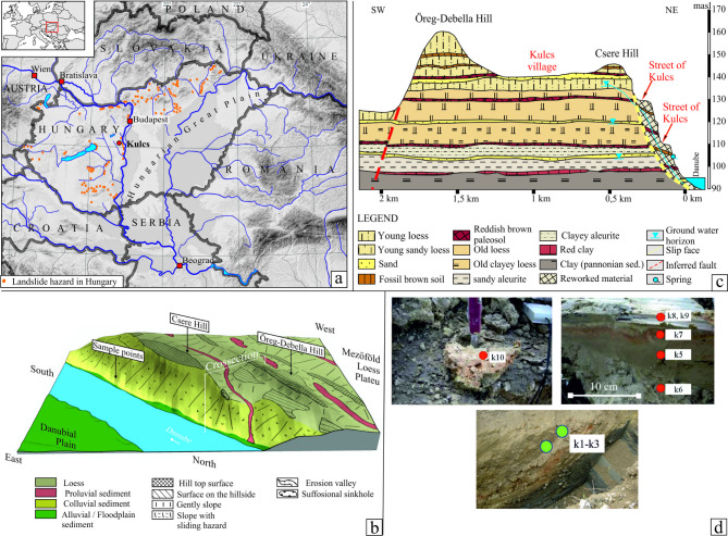
Fig. 1.
Study area, background and selected samples. (a) Location of the investigated area (red dots), where yellow dots indicate landslide areas; (b) Digital elevation model of the investigated area with the overlaying main sediments and main geomorphological characteristics; (c) Geological section of the high bluff at Kulcs. Legend: (1) young loess, (2) young sandy loess, (3) sand, (4) fossil brown soil, (5) reddish brown paleosol, (6) old loess, (7) old clayey loess with deposition horizons of marshes, (8) sandy aleurite, (9) clayey aleurite, (10) red clay, 11. Clay (Zagyva Formation of the Dunántúli Formation Group, Pannonian Sediment), 12. reworked debris slope material, 13. ground water horizons, 14. slip face, and arch of collapses; 15. inferred fault, 16. spring; (d). Photos from the sampling situations. (d). Photos from the sampling situations. The Fig. 1(a) and (b), and (c) were created using CorelDRAW Graphics Suite 2017 and Surfer 8 software, respectively.

