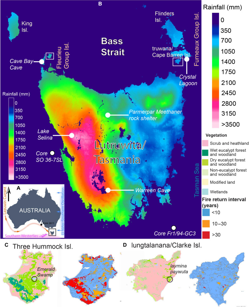
Fig. 1. Climate and vegetation of study area.
Key climatic drivers (A) and annual rainfall distribution across Lutruwita/Tasmania (B), as well as vegetation and fire return interval of study area (60) (C and D)—Three Hummock Island and lungtalanana/Clarke Island in Bass Strait, Lutruwita. Maps [(B) to (D)] were created using LISTmap (60). Key sites later mentioned in the text are shown as well, including the site of climatic records (marine core 2611 and Fr1/94-GC3) offshore southern Australia (33) and southeast Lutruwita (28), existing dated pollen records spanning the past 30,000 to 75,000 years in Lutruwita from Lake Selina (38), offshore western Lutruwita—core SO 36-7SL (34) and Crystal Lagoon on truwana/Cape Barren Island (40), and the two archaeological sites containing the earliest evidence (~40 ka) of human occupation (Warreen Cave and Parmerpar Meethaner rock shelter) in Lutruwita (1).

