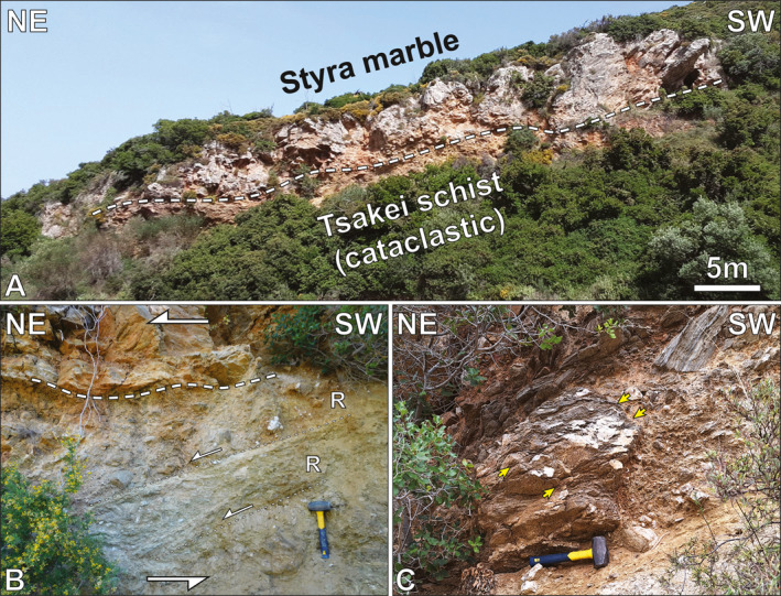
Figure 2.

Field documentation of the Mesochoria cataclasites. (a; zone 35°N, 258568°E, 4236248°N) Cliff face exposing Styra Unit marbles directly overlying cataclasized Tsakei schists. (b; same location as a) Multi‐generational cataclasite below little deformed Styra marble. Synthetic Riedel shears (R) indicate top‐to‐NE shear sense. (c; same location as A) Schist block structurally above the cataclasite horizon showing axial planar cleavage (yellow arrows) at a high angle to foliation within the block. Scale: hammer: 27 cm long.
