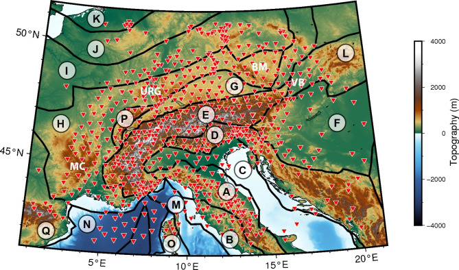
Fig. 1.
Topographic map of the greater Alpine region. Black lines delimit the main geotectonic provinces of the area based on the recent compilation by Hasterok et al. (2022)43: (A) Apennine orogen, (B) Campanian arc, (C) Adriatic-Apulian Foreland, (D) Dinarides, (E) Alps, (F) Pannonian basin, (G) Molasse basin, (H) Moldanubian belt, (I) Saxo-Thuringian belt, (J) Rheno-Hercynian belt, (K) Avalonia, (L) Carpathian mountains, (M) Tyrrhenian basin, (N) Balearic basin, (O) Sardinia-Corsica block, (P) Jura mountains, (Q) Cantabrian-Pyrenean belt. Red triangles denote the locations of seismic stations. MC: Massif Central, URG: Upper Rhine Graben, BM: Bohemian Massif, VB: Vienna Basin. This map was created using PyGMT44.

