
Fig. 1.
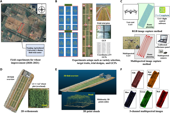
Development of a comprehensive procedural framework for the acquisition and preprocessing of phenotypic data via unmanned aerial vehicles (UAVs). This includes the systematic acquisition of 2-dimensional (2D) RGB and multispectral imagery, followed by the subsequent processes of 2D image stitching and the generation of high-resolution 3-dimensional (3D) point clouds, providing detailed plant-level resolution for the trial field. (A and B) The trial center served as the geographical epicenter for an extensive survey of 160 different wheat varieties. This process involved intricate planning of experimental treatments, experimental layouts, and field setups, including the strategic positioning of ground control points (GCPs). (C) Drones and equipped sensors, as well as flight paths. (D and E) Data preprocessing was systematically performed to generate high-resolution 2D orthomosaics and detailed 3D point clouds, providing plot-level plant resolution for the experimental field. (F) Stitched 5-channel multispectral image.