Fig. 9.
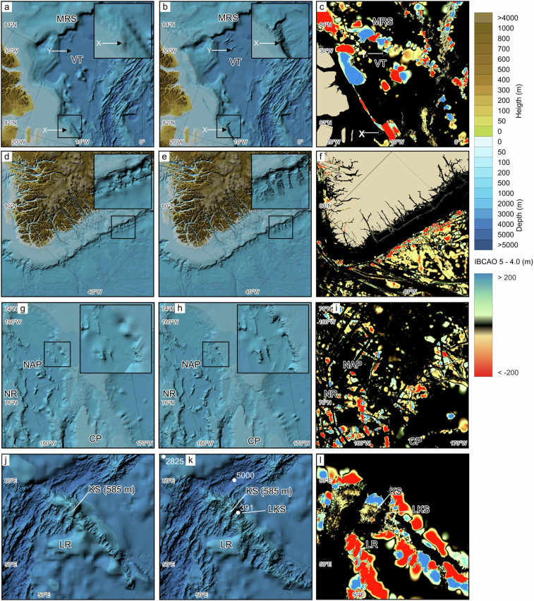
Comparison between IBCAO 4.0 and 5.0 in four selected areas. Locations of the areas are indicated in Fig. 1. The left column depicts IBCAO 4.0, the middle column shows IBCAO 5.0, and the right column displays the depth difference between the two (IBCAO 5.0 - 4.0). Colours toward blue indicate that IBCAO 5 is shallower than IBCAO 4.0, whereas colours towards red show the opposite. (a–c) Area north of the North Greenland continental margin and adjacent deep waters. X marks the significant change from IBCAO 4.0 to 5.0 in the portrayal and location of the continental shelf break and slope. Y shows where new multibeam bathymetry reveals a texture of the Voronov Terrace (VT). MRS = Morris Jesup Spur. (d–f) Southeast Greenland continental slope where new multibeam data reveal a typical slope morphology dominated by canyons. (g–i) Section of the Chukchi Borderland comprising the Northwind Ridge (NR), Northwind Abyssal Plain (NAP) and Chukchi Plateau (CP). Here several new multibeam tracks reveal steeper slopes surrounding the NAP. (j–l) The Langeth Ridge (LR) forming a part of the extensive Gakkel Ridge; the only active spreading ridge in the Arctic Ocean, which has the World ocean’s slowest spreading rates varying between about 6 and 13 mm/year193.

