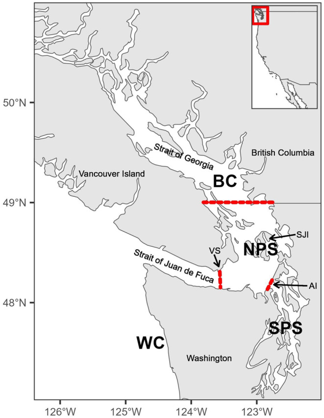
FIGURE 1.

Map showing the sampling regions defined in this study. Sampling areas are north Puget Sound (NPS), south Puget Sound (SPS), British Columbia (BC), and the Washington Coast (WC) and are separated by the red lines for the purpose of this study. Victoria Sill (VS), San Juan Islands (SJI) and Admiralty Inlet (AI) are known biogeographic barriers in the region and were used to define the sampling areas.
