

Abstract
In light of the Chinese government’s dual carbon goals, achieving cleaner production activities has become a central focus, with regional environmental collaborative governance, including the management of agricultural carbon reduction, emerging as a mainstream approach. This study examines 268 prefecture-level cities in China, measuring the carbon emission efficiency of city agriculture from 2001 to 2022. By integrating social network analysis and a modified gravity model, the study reveals the characteristics of the spatial association network of city agricultural carbon emission efficiency in China. Additionally, the quadratic assignment procedure is employed to investigate the driving factors. The findings indicate that: (1) The carbon emission efficiency of cities agriculture in China displays substantial spatiotemporal heterogeneity, characterized by marked regional clustering. Central cities generally exhibit higher efficiency levels, while the surrounding cities tend to have lower efficiency. (2) The carbon emission efficiency of city agriculture in China displays multidimensional, complex, and organic characteristics, with potential for enhanced network stability. (3) Agricultural regions in central and southeastern China dominate the spatial network, while regions with weaker agricultural sectors, like Beijing, Shanghai, and Ningxia, occupy peripheral positions. (4) Within the spatial association network of city agricultural carbon emission efficiency in China, Intra block spatial correlations are low, while interblock spatial correlations are strong, exhibiting significant spillover effects. (5)Variations in agricultural development levels and mechanization significantly enhance the formation of networks related to city agricultural carbon emission efficiency in China. Conversely, differences in industrial structure and fertilizer application levels exert a substantial negative influence on these networks.
Keywords: Chinese cities, Agricultural carbon emission efficiency, Spatial association network structure, Driving factors
Subject terms: Ecology, Environmental sciences, Environmental social sciences
Introduction
The escalating severity of global climate change has prompted concerted responses from the international community and national governments. The United Nations Framework Convention on Climate Change (UNFCCC) and the Paris Agreement of 2015 have established critical guidelines for nations in formulating climate policies, setting the goal of limiting the global average temperature increase to within 2 °C above pre-industrial levels. In alignment with these global initiatives, China has implemented significant policy measures. The ‘14th Five-Year Plan for National Economic and Social Development of the People’s Republic of China and the Outline of the 2035 Vision Goals’ explicitly addresses the issue of agricultural carbon emissions, with the Chinese government committing to achieving carbon peak by 2030 and carbon neutrality by 2060. These international accords and national policies necessitate more stringent measures in agricultural production and carbon emission management, providing a crucial context for investigating the spatial characteristics of carbon emission efficiency in urban agriculture within China. A scientific analysis of various carbon sources and developing countermeasures are essential to meet these targets. Agriculture stands as a major contributor to global carbon emissions, representing around 17% of the total emissions in China. Despite not being the foremost source of carbon emissions within the country, the vast scale and significant emissions from agricultural activities highlight the need for more sustainable and carbon-efficient practices in this sector. This consideration is vital in addressing carbon emissions, a core issue in pollution control1. On the other hand, methane produced during crop growth and carbon dioxide emitted from agricultural chemicals contributes to regional climate change. These emissions can alter local meteorological conditions such as temperature and precipitation, indirectly increasing the likelihood of extreme events and pest outbreaks, thus impacting the sustainable development of regional agriculture2. As essential hubs for living, production, and ecological activities, cities serve as central points for resource aggregation and are also the primary zones for energy usage and carbon output3. Statistics indicate that city areas contribute to 75–80% of global carbon emissions, with China’s city emissions reaching up to 85%4. This highlights the significant impact of the city’s economic and social development on carbon output. Simultaneously, the formation of regional transportation networks and the growth of city agriculture, along with the progress of coordinated regional development strategies, have bolstered agricultural economic links between cities5. The rapid movement of population and capital intensifies agricultural ties between cities within the same geographic area, producing similar agricultural products and increasingly close agricultural connections among cities. Additionally, the escalating environmental challenges have surpassed individual administrative boundaries, becoming intricate regional issues. Enhancing collaborative efforts among various city entities within a region and focusing on agricultural carbon emission efficiency(ACEE)—which accounts for both agricultural output value and carbon emissions—can accurately reflect the agricultural productivity and the progress of sustainable agricultural development in the area. Such research holds significant practical value for developing agriculture and rural areas6. Thus, considering city ACEE, establishing an inter-city collaborative governance network for managing agricultural carbon emissions emerges as a crucial innovation for addressing regional environmental challenges.
Currently, regional differences in the efficiency of agricultural carbon emissions are reflected in a number of ways, including regional, urban and rural. Cities serve as nexuses of agricultural modernization and innovation diffusion, playing an instrumental role in shaping the trajectory of agricultural carbon emissions. They function as core areas for agricultural carbon emissions and act as conduits for transferring advanced technologies to rural areas, thereby driving the reduction of overall agricultural carbon emissions. This urban-to-rural technology diffusion underscores the importance of studying ACEE at the city level. Moreover, the ongoing urban-rural integration in China positions cities as critical nodes in the agricultural value chain, blurring traditional boundaries between urban and rural agricultural activities. From a data perspective, cities offer unique advantages in terms of quality and availability. Urban areas typically have more standardized data collection processes, reducing measurement errors and operational variable biases that are often prevalent in rural data. The finer granularity of city-level data allows for more precise statistical inferences. The panel data structure of 268 prefecture-level cities from 2001 to 2022 provides a substantial sample size, enhancing statistical power and allowing for control of time and individual fixed effects, thus mitigating omitted variable bias. Methodologically, city-scale analysis is particularly suited for constructing and analyzing spatial association networks, revealing more detailed patterns of spatial interactions in agricultural practices and efficiencies. Additionally, cities represent the forefront of agricultural modernization and intensification, making them ideal subjects for studying the future trajectory of agricultural carbon emissions. Lastly, with China’s ongoing emphasis on urban agglomeration and metropolitan area development, city-level research offers direct policy relevance for sustainable urban planning and rural-urban integration strategies. By focusing on city-level ACEE, this study not only addresses data quality concerns but also provides a unique research perspective with significant implications for both academic literature and policy formulation in the context of China’s evolving agricultural landscape and carbon reduction goals. In summary, although urban carbon emissions are currently the focus of research, agricultural carbon emissions are also worth exploring in urban areas.
Therefore, This study examines city ACEE and investigates the structural features and mechanisms of the spatial association network of city agricultural carbon emissions in China using spatial network analysis. It offers substantial theoretical and practical value by promoting city agricultural cooperation, establishing inter-city collaborative mechanisms for improving carbon emission efficiency, and formulating tailored agricultural energy conservation and emission reduction policies. Moreover, it provides valuable insights and support for the advancement of modern city agriculture on a global scale.
Literature review
Since the 1970s, carbon emissions caused by human activities and global warming have been hot topics of discussion in the academic community. Research has primarily focused on multiple aspects, including carbon emission accounting, spatiotemporal differences in carbon emissions, and carbon emission efficiency.
The calculation of carbon emissions constitutes the foundation for all quantitative studies concerning carbon emissions, necessitating the availability of robust and scientifically accurate data. This accuracy is paramount for developing effective mitigation strategies and policies aimed at reducing carbon footprints across various sectors. In the context of China, official statistics on carbon emissions from the agricultural sector are notably absent. As a result, estimates are typically generated by converting agricultural crop yields into carbon emission equivalents. This reliance on estimation rather than direct measurement introduces potential inaccuracies and inconsistencies in data reporting and analysis. The “2006 IPCC Guidelines for National Greenhouse Gas Inventories” endorse the input-output method for calculating carbon emissions7,8. This method accounts for the carbon emissions generated at various stages of the production process, providing a comprehensive assessment of the carbon footprint associated with different economic activities. Scholars have refined and adapted the carbon emission coefficient method to better suit the calculation of emissions in diverse regions9,10. This method involves applying region-specific coefficients to estimate emissions more accurately, reflecting the unique characteristics of each area. The direct measurement method utilizes actual baseline data obtained directly from emission sources to compile related carbon emissions11–13. This approach ensures high accuracy and reliability in the reported emission figures, as it relies on empirical data rather than estimations or projections. Although the material balance method offers a systematic and comprehensive approach to carbon emission estimation, it necessitates extensive data collection, which can be both challenging and resource-intensive14,15. The method involves accounting for all inputs and outputs in a system, thereby providing a thorough assessment of the carbon emissions associated with specific processes. The “bookkeeping” model is employed to estimate land-use carbon emissions on a global scale and for individual countries, establishing a foundational framework for future research16. This model aggregates data on land-use changes and their associated carbon emissions, offering valuable insights into the global carbon cycle and the impact of land-use practices on carbon emissions. This method, based on actual field surveys, estimates carbon storage in vegetation, litter, or soil carbon pools and is frequently used for assessing forest carbon storage17,18. By measuring carbon stocks directly in the field, this method provides precise and site-specific data on carbon storage, which is crucial for understanding and managing carbon sequestration in forest ecosystems.
Recent years have witnessed significant advancements in the methodologies for calculating agricultural carbon emissions and assessing their current status. Cheng et al.19 pioneered a systematic estimation of the carbon footprint of crop production in China, establishing a comprehensive calculation model that considered various agricultural inputs, thus laying a methodological foundation for subsequent research. Johnson et al.20. analyzed the primary sources of greenhouse gas emissions in agriculture from a macro perspective, exploring potential mitigation strategies and providing a theoretical basis for formulating agricultural emission reduction policies.
As research has progressed, scholars have begun to focus on the dynamic evolution and spatial characteristics of agricultural carbon emissions. Tian and Yin21 updated the baseline data on agricultural carbon emissions in China and systematically studied their spatial spillover effects, revealing significant regional differences and spatial clustering phenomena. Cui et al.22 considered the carbon sink effect, constructing a more comprehensive agricultural carbon emission accounting model that identified key factors contributing to regional differences, thereby providing a basis for formulating regionally differentiated emission reduction policies.
Furthermore, Huo et al.23 focused on the relationship between agricultural production efficiency and carbon emissions. Through empirical analysis, they found that improvements in agricultural production efficiency generally contribute to reducing carbon emissions, although differences exist across regions and types of agricultural activities. These studies collectively build a comprehensive understanding of agricultural carbon emissions in China, providing an important theoretical foundation and comparative reference for the present study.
Agricultural carbon emissions display considerable spatial and temporal variations, making the study of their spatial patterns essential for crafting effective carbon reduction policies24,25. A substantial body of research has investigated the spatial patterns of carbon emissions from various sources, using administrative boundaries and multiple scales, including national, regional, provincial, and county levels26–30. For instance, Jiang and Ma utilized social network analysis to illustrate the spatial association network of carbon emissions among OECD countries31. At the provincial level, Hou and colleagues employed the CCD model to explore the synergistic effects of agricultural pollution and carbon reduction, examining regional differences and spatiotemporal heterogeneity32. Research generally uses single spatial scales, revealing that spatiotemporal patterns can vary within the same region depending on the scale. Techniques such as spatial autocorrelation analysis, standard deviational ellipse, and hot and cold spot analysis are applied to investigate spatial clustering and differentiation33–35. These methods highlight the importance of understanding regional and temporal variations in agricultural carbon emissions to develop effective policy and mitigation strategies.
The academic community lacks a consensus on the definition of carbon emission efficiency, interpreting it from two main perspectives: single-factor and total-factor efficiency. Single-factor efficiency is measured by the ratio of a single factor to carbon emissions or vice versa36,37. Although this method is straightforward and data is easily obtainable, it is often criticized for not accurately reflecting true carbon emission efficiency. In contrast, total-factor efficiency incorporates various input-output factors and is primarily measured using Stochastic Frontier Analysis (SFA) and Data Envelopment Analysis (DEA)38–40. SFA is suitable for scenarios with multiple inputs and a single output41, whereas DEA is favored in decision-making and scientific management due to its capability to handle multiple inputs and outputs, with research conducted at regional, inter-provincial, and city levels42. This bifurcated approach emphasizes the need for a standardized and comprehensive framework to accurately capture the complexities of carbon emissions in diverse contexts.
Extensive scholarly research has been conducted on carbon emission accounting, spatiotemporal variations, and carbon emission efficiency, laying a robust theoretical and methodological foundation for this paper’s examination of city ACEE. However, most existing studies primarily focus on “attribute data,” often neglecting the crucial aspect of “relational data.” This study addresses this gap by investigating the spatial association network and the driving factors of city ACEE in China, utilizing relational data and network analysis. Previous research has largely concentrated on the provincial level, thus overlooking the complexity of spatial associations at the city level. To overcome this limitation, the study employs panel data from 268 prefecture-level cities spanning the period from 2000 to 2021. This comprehensive dataset enables a detailed analysis of the spatial association network structure of city ACEE, capturing the intricate interactions at the city level and their influence on carbon emissions.
Furthermore, while traditional DEA models like CCR, BCC, and SBM have been extensively utilized in prior research, they are inherently static. This study employs a dynamic DEA model that integrates carry-over variables to link different periods, offering a more comprehensive perspective on efficiency changes over time43. Specifically, an improved common frontier dynamic super-efficiency SBM model is developed to measure overall efficiency across multiple periods. This model enhances the analysis by accounting for the dynamic nature of carbon emissions and their efficiency, thus providing more precise and actionable insights into the temporal evolution of efficiency metrics.
By integrating dynamic modeling with network analysis, this study advances the methodological toolkit for examining carbon emissions and offers a more comprehensive and interconnected perspective on city ACEE. This innovative approach is critical for developing targeted and effective carbon reduction policies at the city level, addressing both the immediate and long-term challenges associated with city agricultural practices. The findings of this paper are expected to contribute significantly to the literature by highlighting the importance of considering relational data and dynamic efficiency measures, thereby paving the way for more integrated and effective strategies in managing city agricultural carbon emissions.
This study employs an enhanced common frontier dynamic super-efficiency SBM model to calculate the carbon emission efficiency of city agriculture in China, thereby improving scientific rigor and reliability. By addressing practical challenges in achieving China’s “dual carbon goals,” the research aligns with the real-world needs of “green agriculture efficient development” and “ecological civilization construction”44. Utilizing panel data from 2000 to 2021, the study encompasses 268 prefecture-level cities, offering a comprehensive temporal and spatial analysis. Advanced methodologies, including the improved SBM model, modified gravity model, social network analysis, and QAP model, are utilized to examine the characteristics and driving factors of the spatial association network structure of city ACEE in China. These approaches provide a multifaceted analysis that combines efficiency measurement with spatial and network perspectives, giving a holistic view of the factors influencing carbon emissions at the city level. The findings from this study are crucial for decision-making, supporting collaborative improvements in city ACEE. By identifying key drivers and spatial patterns, the research offers strategic insights aimed at achieving the dual carbon goals, which are essential for China’s broader environmental and economic objectives. Furthermore, the insights gained from this analysis promote sustainable development, supporting both ecological and economic sustainability. The emphasis on practical applications ensures that the research not only advances academic knowledge but also has tangible impacts on policy and practice, fostering a more sustainable and efficient agricultural sector in the city of China.
Marginal contribution
(1) Research perspective: The study extends the spatial association network analysis of Agricultural Carbon Emission Efficiency (ACEE) to 268 prefecture-level cities, addressing a gap in the existing literature that predominantly focused on provincial or national scales. This granular approach enables more precise observations of ACEE’s spatial heterogeneity and transmission characteristics, offering a novel analytical dimension for comprehending the spatial dynamics of agricultural carbon emission efficiency in Chinese urban areas. (2) Research indicators: The study utilizes “relational” data in ACEE research, incorporating inter-city variables such as agricultural development levels, industrial structures, agricultural mechanization, fertilizer application, and government intervention. This approach provides a more comprehensive depiction of ACEE spatial association characteristics in Chinese cities. The application of this method enhances the QAP model’s applicability and enriches the data foundation for spatial association analysis in the ACEE domain. (3) Research methods: The study employs an improved common frontier dynamic super-efficiency SBM model that accounts for temporal dynamics and incorporates undesirable outputs, thus overcoming limitations inherent in traditional static DEA models. A modified gravity model is integrated with social network analysis, introducing economic-geographical distance to more accurately reflect inter-city ACEE interactions. Additionally, QAP regression analysis uses “relational” data in place of conventional “attribute” data, effectively addressing network data autocorrelation and enabling more precise identification of key factors influencing ACEE spatial associations. (4) Policy Implications: The findings of this research have potential applications in formulating regional agricultural carbon reduction policies and fostering inter-city collaborative emission reduction efforts. By providing empirical analysis and scientific data, the study offers a reference base for governmental bodies to develop regional low-carbon development strategies. The research outcomes align with the practical imperatives of promoting green agriculture and constructing an ecological civilization, thereby providing scientific support for the development of sustainable urban agricultural strategies.
Research design
Research methods
Improved common frontier dynamic super-efficiency SBM model
This paper initially incorporates a dynamic DEA model, classifying carry-over variables into four categories: ideal (good), undesirable (bad), free, and fixed. The model sets up independent decision-making units (DMUs) across multiple periods, with each period featuring distinct and independent inputs and outputs. These inputs and outputs act as carry-over variables from one period to the next, as represented by Eq. (1):
 |
1 |
Equation (1) categorizes the  variables into ideal, undesirable, free, and fixed types. Non-oriented total efficiency
  calculated using Eq. (2), where
  and
and  represent weights for that term and the input items, respectively.
 |
2 |
The efficiency of non-oriented individual indicators is calculated as follows:
 |
3 |
Building on the dynamic DEA model, the improved common frontier dynamic super-efficiency SBM model is employed to calculate total factor energy efficiency. Under various management types, resources, planning, and environmental factors, this paper assumes that all units  are composed of decision-making units
  grouped into
  groups
  .
.  and
and  respectively represent the input
  and output
  items under the common frontier for
  . The
. The  value for
  can select the most favorable final output weights, thereby achieving the maximum efficiency value. The common frontier technical efficiency value
  for
for  can be solved using Eq. (4):
 |
 |
 |
 |
 |
 |
 |
4 |
Modified gravity model
In the selection of models, previous research investigating the spatial correlation characteristics of carbon emissions has frequently employed vector autoregression models or gravity models. Studies have highlighted that economic, geographic, and demographic factors play significant roles in shaping agricultural carbon emission associations45. Building on this foundation, and informed by established research findings46, this study introduces a modified gravity model to validate the inter-city relationships within China’s spatial network of agricultural carbon emissions. The specific model employed is detailed as follows:
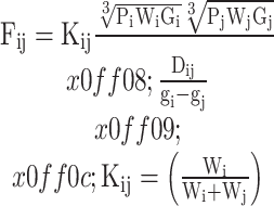 |
5 |
In the formula:  represents the strength of the connection between cities
  and
and  ;
;  denotes the contribution rate of province
  to
to  ; W represents the efficiency of agricultural carbon emissions; P denotes the year-end permanent rural population; G represents the added value of agriculture, forestry, animal husbandry, and fisheries(AVAFHF);
  denotes the per capita AVAFHF;
  represents the distance between provinces and their capital cities;
  signifies the economic geographic distance separating two cities. Utilizing Eq. (5), the spatial association gravity matrix is computed. By applying the mean value as a threshold, the matrix is then binarized to derive the spatial binary matrix of ACEE for the cities.
Social network analysis
The importance of Social Network Analysis (SNA) lies in its capability to examine the relationships among network members, thereby reflecting their associative structures and attribute characteristics. SNA addresses the limitations of individual-focused research, attribute research, and traditional quantitative studies, making it broadly applicable in disciplines such as psychology and economics47. The overall network structure is evaluated using indicators like network density, connectivity, hierarchy, and efficiency, while individual network structures are assessed through degree centrality, closeness centrality, and betweenness centrality. Block models further depict the network’s internal structure, revealing the internal state, positions, and roles of members through spatial clustering, with members having similar roles forming a block. In the context of city ACEE in China, the spatial association network is segmented into four block types: net spillover, bidirectional spillover, primary beneficiary, and broker. These classifications are derived from detailed centrality metrics and specific content adapted from existing literature48,23. This approach facilitates a nuanced understanding of the spatial association network of city ACEE, highlighting the roles and interactions of different members within the network. By employing SNA, the study offers a comprehensive analysis of the relational dynamics that influence carbon emission efficiency, providing valuable insights for policy-making and the development of targeted interventions to enhance sustainability in city agriculture.
Quadratic assignment procedure (QAP) model
The Quadratic Assignment Procedure (QAP) is a method that investigates the relationships between corresponding elements in two or more matrices through the permutation of matrix data. This method is utilized for matrix correlation and regression analyses, offering a robust approach to understanding complex interdependencies within the data. It effectively addresses challenges such as multicollinearity and spurious correlations, leading to more reliable findings49. Building on previous research50,51, this study employs the QAP model to examine the formation and driving factors of the network structure of city ACEE in China. The constructed econometric model is detailed as follows:
 |
6 |
In the equation,  represents the spatial network relationship matrix of the study subject, and
  denotes the matrix comprising the influencing factors.
Selection of indicators and data sources
Based on the analysis of the primary sources of carbon emissions, agricultural carbon emissions primarily originate from pesticides, fertilizers, the use of agricultural machinery, and tillage.
① Labor Input Indicator: The number of employed individuals is an indicator of labor’s contribution to ACEE. Therefore, following research findings52, the total number of primary sector workers in each prefecture-level city is used as the labor input measure. ② Capital Input Indicator: Drawing on existing literature53, the sowing area of grain crops, actual irrigated area, and agricultural machinery investment are used to measure capital input. ③ Energy Input Indicator: Following the practices outlined in related literature15,54, the total energy consumption is measured by the electricity usage for city agriculture and the application of pesticides and fertilizers.
The output indicators are composite indices derived using the entropy method, capturing both the beneficial services and production generated during socio-economic development and the negative environmental impacts associated with these activities. ① Desired Output Indicator: Drawing on the findings of recent research55, the AVAFHF is selected to represent the desired outputs. ② Undesired Output Indicator: Following existing research52, city agricultural carbon emissions are chosen as the measure for undesired outputs. These emissions encompass those from agricultural inputs like fertilizers, pesticides, and agricultural films, as well as direct energy sources such as diesel and gasoline, and indirect energy sources including electricity and thermal energy. Given the focus of this study on ACEE, this selection for the undesired output is deemed appropriate.
This study leverages panel data from 268 prefecture-level cities in China, spanning the period from 2000 to 2022, excluding Hong Kong, Macau, and Taiwan, due to the accessibility and comparability of the data. The data sources include the “China City Statistical Yearbook,” “China Agricultural Statistical Yearbook,” “China Environmental Statistical Yearbook,” the National Bureau of Statistics Data Center, and various statistical yearbooks from the prefecture-level cities. To address instances of missing data for specific cities and years, interpolation methods are employed to ensure data completeness. Additionally, eight evaluation indicators are selected from both input and output dimensions to calculate the city ACEE of these cities, as detailed in Table 1.
Table 1.
Indicators for calculating ACEE in Chinese cities.
| Primary indicator | Secondary indicator | Tertiary indicator | Unit |
|---|---|---|---|
| Input indicators | Labor | Primary sector workforce | Million people |
| Capital | Grain crop sowing area | hm2 | |
| Actual irrigated area | hm2 | ||
| Agricultural machinery investment | kw | ||
| Energy | Agricultural electricity consumption | kw/h | |
| Fertilizer application rates | Million tonnes | ||
| Desired outputs | TAV of AF, F, AH, and F | Total output value of AVAFHF | Million yuan |
| Undesired outputs | Agricultural carbon emissions | Agricultural carbon emissions encompass emissions from the use of chemical fertilizers, pesticides, and agricultural films, as well as direct emissions from diesel and gasoline. Additionally, they include emissions from indirect energy sources such as electricity and thermal energy | Million tonnes |
Results analysis
Analysis of ACEE in Chinese cities
Temporal dynamic evolution characteristics
This study employs agricultural input–output indicator data to compute the carbon emission efficiency of agriculture for 268 cities in China over the period from 2001 to 2022. Following the computation, a temporal evolution analysis is performed. The mean values and coefficients of variation for city ACEE across China during the study period are depicted in Fig. 1.
Fig. 1.

Analysis of the mean and coefficient of variation of ACEE in Chinese cities.
From 2001 to 2022, the ACEE in Chinese cities exhibited significant fluctuations and distinct phase characteristics. During the Improvement Period from 2001 to 2008, efficiency rose from 0.174 in 2000 to 0.234 in 2008. Concurrently, the coefficient of variation decreased from 0.854 to 0.665, indicating reduced disparities among cities. This improvement can be attributed to China’s accession to the WTO, which facilitated the modernization of agriculture and the adoption of advanced agricultural technologies. These changes fostered greater efficiency and uniformity in agricultural practices across various regions. However, in 2009, there was a sharp decline in efficiency to 0.092, accompanied by an increase in the coefficient of variation to 1.022. This downturn was likely caused by extreme weather events and the Wenchuan earthquake, which severely damaged agricultural infrastructure and disrupted production processes. The adverse environmental conditions and infrastructural challenges during this period underscored the vulnerability of the agricultural sector to natural disasters and highlighted the need for resilient agricultural practices. From 2013 to 2018, a downward trend in ACEE was observed, with efficiency declining from 0.241 in 2013 to 0.149 in 2018. This decline was primarily due to increased energy dependency and environmental pollution issues arising from agricultural mechanization and the excessive use of fertilizers. The over-reliance on energy-intensive practices and the environmental degradation associated with them posed significant challenges to maintaining high levels of efficiency. The period from 2018 to 2020 saw an improvement in efficiency, driven by the implementation of energy consumption control policies and an optimized energy structure. During this time, there was a growing societal emphasis on quality of life and environmental awareness, which spurred efforts to reduce carbon emissions and enhance sustainability in agriculture. These policies and societal shifts contributed to a more favorable efficiency trajectory, highlighting the positive impact of regulatory and public awareness measures. The onset of the COVID-19 pandemic in 2021 brought about a significant downward trend in ACEE. The pandemic’s impact led to a focus on maintaining basic agricultural production to ensure food security, resulting in high growth rates in agricultural output. However, the pandemic also hindered efforts to decrease energy intensity and carbon emission intensity, resulting in less-than-ideal progress in efficiency improvements. The challenges posed by the pandemic emphasized the need for robust strategies to balance agricultural productivity with environmental sustainability, even in times of crisis. Overall, there remains substantial potential for enhancing the carbon emission efficiency of city agriculture in China. To realize this potential, it is essential to promote a clean, low-carbon transformation in the agricultural sector. This involves increasing the security and supply capacity of agricultural products while stabilizing and improving ACEE. Investments in sustainable agricultural practices, technological innovation, and infrastructure resilience are critical to achieving these goals. Moreover, policies that incentivize low-carbon technologies and practices, coupled with public awareness campaigns on the importance of sustainable agriculture, can drive significant improvements in efficiency. Efforts to improve carbon emission efficiency must also address the disparities among different regions. Tailored strategies that consider the unique environmental, economic, and social conditions of each region are necessary to ensure equitable and effective outcomes. By fostering collaboration among government agencies, research institutions, and agricultural enterprises, it is possible to develop comprehensive solutions that enhance efficiency across the board. The trend analysis from 2001 to 2022 reveals both the challenges and opportunities in improving ACEE in Chinese cities. While there have been periods of significant improvement, setbacks due to natural disasters and the pandemic have highlighted the need for resilience and sustainability. Moving forward, a concerted effort to promote clean, low-carbon agricultural practices, supported by robust policies and investments, can unlock the potential for substantial efficiency gains and contribute to the broader goals of environmental sustainability and economic development in China. This multifaceted approach, integrating technological, economic, and policy measures, is crucial for advancing China’s agricultural sector toward a more sustainable and efficient future. By addressing both immediate and long-term challenges, this strategy ensures that the agricultural sector can meet its dual carbon goals and support the nation’s overall development objectives.
To further reveal the temporal dynamics and variations in ACEE across Chinese cities, a kernel density function was employed to estimate these differences, as illustrated in Fig. 2.
Fig. 2.

Kernel density analysis of ACEE in Chinese cities.
Figure 2 reveals that the kernel density distribution of city ACEE in China predominantly peaks between 0 and 0.5, indicating significant clustering within this range. In 2021, a slight decline in the peak value suggests a reduction in the concentration level of ACEE nationwide. The center and range of the kernel density curve shifted leftward and then rightward, reflecting overall fluctuations in ACEE. Additionally, the curve displays a pronounced rightward tail, indicating spatial multipolarity with some cities achieving relatively high efficiency. This “peak first rising then falling, width narrowing then expanding” pattern suggests an increasing disparity in ACEE among high-value areas. While some cities have managed to achieve high efficiency, the gap between these high-efficiency cities and others has widened. This trend underscores the necessity for targeted policies to address these disparities and promote uniform improvements in carbon emission efficiency across city agricultural sectors.
Spatial pattern evolution characteristics
Employing ArcGIS software to visualize the spatial distribution of ACEE in China, as depicted in Fig. 3, reveals notable spatial heterogeneity. From 2008 to 2015, there was a general trend of fluctuating growth in city ACEE, influenced by the “dual carbon” goals. However, a marked decline was observed in 2022, indicating significant variability across different regions. In terms of distribution patterns, there is a clear apparent geographical differentiation; regional clustering is evident, with higher efficiencies in central cities and lower in surrounding ones. City-specific analysis shows that cities with low efficiency include Shaoxing, Kaifeng, and Shanghai; those with relatively low efficiency are Nanjing, Yuncheng, and Anyang; cities with moderate efficiency include Qinzhou, Tongliao, and Zhanjiang; while Maoming, Yueyang, and Zhuhai have relatively high efficiency. Cities such as Qingyuan, Heyuan, Ningbo, and Bazhong demonstrate high efficiency values. In the eastern regions, where the economy is primarily driven by secondary and tertiary industries, agricultural output is relatively low, rendering agriculture less significant in the overall economic structure. This situation results in inadequate investment in agricultural carbon reduction technologies, leading to higher carbon emission intensities and lower carbon emission efficiencies in city agricultural production. Conversely, in the western regions, several cities focus on cultivating cash crops, which generate a higher output value per unit of cultivated land compared to grain crops. In mountainous areas like Guangxi and Guizhou, where agricultural mechanization is limited and cultivation scales are smaller, the use of diesel and gasoline is reduced, leading to lower carbon emissions and higher ACEE. In the northeastern regions, the flat terrain facilitates extensive use of agricultural machinery, which is essential for maintaining high agricultural output. However, this extensive mechanization results in significant carbon dioxide emissions, placing these areas at a moderate efficiency level.
Fig. 3.

Evolution of spatial pattern of ACEE in Chinese cities. (a) ACEE in Chinese cities, 2001. (b) ACEE in Chinese cities, 2008. (c) ACEE in Chinese cities, 2015. (d) ACEE in Chinese cities, 2022.
Overall network structure characteristics
The spatial transmission of ACEE among Chinese cities involves the inter-city dissemination and exchange of efficiency, forming cross-regional spatial association networks56. The study calculates the ACEE of 268 cities from 2001 to 2022 and constructs a spatial association network based on a modified gravity model. Cross-sectional data of the top 100 cities by association strength for the years 2001, 2008, 2015, and 2022 are visualized to analyze dynamic evolution trends (Fig. 4). With increased population, economic activity, information flow, and technological exchange, the spillover effects of agricultural carbon emissions have become more pronounced. The dual control policy on energy consumption has made the spatial association network more complex and networked. The spatial association network evolved from small groups to a unipolar core-type diffusion and eventually to a multipolar core-type structure. The association centers shifted from the eastern coastal areas to the central and western regions, resulting in a “one point, four axes” development pattern. This pattern includes the Central Plains Economic Belt as the inner growth pole and external growth poles around Central Yunnan, the Northern Slope of Tianshan, Harbin-Changchun, and the Pearl River Delta. The evolution of the spatial structure highlights the dynamic nature of inter-city interactions and the growing complexity of spatial relationships in ACEE. This transformation reflects the impact of national policies and regional development strategies on the spatial dynamics of carbon emission efficiency. By analyzing these patterns, the study provides insights into the mechanisms driving the spatial transmission of efficiency and underscores the importance of coordinated regional policies to enhance overall carbon emission efficiency. The findings suggest that targeted interventions in key growth poles and along the identified development axes can foster more balanced and sustainable agricultural practices, contributing to the broader goals of reducing carbon emissions and promoting environmental sustainability. This comprehensive understanding of spatial transmission and network evolution is crucial for formulating effective strategies that address regional disparities and leverage the strengths of interconnected city areas in China.
Fig. 4.

Spatial correlation network of ACEE in Chinese cities. (a) Top 100 cities in China in terms of ACEE network correlation intensity, 2000. (b) Top 100 cities in China in terms of ACEE network correlation intensity, 2007. (c) Top 100 cities in China in terms of ACEE network correlation intensity, 2014. (d) Top 100 cities in China in terms of ACEE network correlation intensity, 2021.
During the study period, the center of spatial correlation of agricultural carbon emission efficiency gradually shifted from the eastern coast to the central and western regions, which contrasts with the findings of previous studies (e.g., Xueqiang et al.57) that the central and eastern coasts dominate the region, suggesting that the mobility of resources and factors among cities in China has increased under the policy of coordinated regional development. The linkages among the three major urban agglomerations of the Central Plains, the northern slopes of the Tianshan Mountains, and the Pearl River Delta (PRD) show a complex and intertwined network structure, suggesting that the “dual control of energy consumption” policy and the “green and low-carbon” development strategy effectively weakened the anthropogenic barriers to the flow of resources and promoted a synergistic improvement of the carbon emission efficiency of cities in the region. It shows that the “dual control of energy consumption” policy and the “green and low-carbon” development strategy have effectively weakened the artificial barriers in the circulation of resources and promoted the synergistic improvement of carbon emission across regions. These policies and measures have played an important role in facilitating the cross-regional circulation of carbon emission resources and factors, promoting the position of the central and western regions in the national agricultural carbon emission efficiency improvement network, and realizing the cross-regional optimal allocation of efficiency factors.
As shown in Fig. 5, From 2001 to 2022, the density of the ACEE network among Chinese cities exhibited slight fluctuations but remained low overall, indicating limited spatial associations and significant room for improvement. The number of network connections also fluctuated, highlighting a relatively loose network structure and the need for strengthened regional cooperation. In key years such as 2011, 2021, and 2022, the number of network connections was notably low, emphasizing the need to enhance spatial cooperation and resource optimization in ACEE among cities. The degree centrality of the network showed a trend of first declining and then rising, decreasing from 0.1975 in 2001 to 0.1354 in 2018, and then increasing to 0.4141 in 2022. This trend indicates a weakening hierarchical structure within the network before 2018, with increasing inter-city connections, but growing disparities in city statuses within the network from 2019 to 2022. The overall efficiency of the spatial association network showed a slight upward trend, with an increase in the number of connecting lines. However, redundancy in spatial associations and diminishing overlapping spillover channels affected network stability. Despite the initial tightening of spatial associations from 2001 to 2018, the period from 2019 to 2022 saw significant disparities in efficiency among cities, indicating a distinct hierarchical structure and more dispersed development. This suggests that while there was an increase in connections, these were not uniformly distributed, leading to inequalities in the network’s development. The analysis highlights the need for policies that promote more uniform and equitable spatial associations to optimize ACEE. Enhancing regional cooperation, reducing redundancy in network connections, and ensuring balanced development across different city regions are crucial steps towards achieving a more integrated and efficient network. The findings underscore the importance of addressing both the connectivity and hierarchical disparities within the network to foster a more cohesive and effective approach to managing agricultural carbon emissions. In conclusion, while there have been improvements in the spatial association network of ACEE among Chinese cities, significant challenges remain. The fluctuations in network density and connections, the varying degree centrality trends, and the disparities in overall network efficiency all point to the need for targeted interventions. Strengthening regional cooperation, enhancing spatial resource optimization, and addressing the hierarchical disparities within the network are essential for achieving sustainable and efficient agricultural practices across Chinese cities.
Fig. 5.

Trends in the evolution of the overall network structure characteristics of ACEE in Chinese cities.
Individual network structure characteristics
The centrality characteristics of the spatial association network of city ACEE are analyzed using data from 2001 to 2022 (Fig. 6) to elucidate the roles and positions of various provinces within the network.
Fig. 6.

Network centrality analysis of ACEE in Chinese cities. (a) Degree centre degree. (b) Inter mediation centrality. (c) Proximity to the center.
Degree centrality.
During the study period, the average degree of centrality showed a general downward trend from 0.393 in 2001 to 0.333 in 2022, indicating a gradual dispersion of spatial connections among provinces. Provinces like Guangdong, Sichuan, Inner Mongolia, Heilongjiang, and Hunan saw a significant increase in degree centrality, reflecting strengthened network connections and their growing influence within the ACEE network. Conversely, provinces such as Jiangsu, Fujian, Zhejiang, and Shandong experienced a decline in degree centrality, yet they maintained relatively high positions within the network due to their robust economic development and established infrastructures. Less economically developed or remote provinces like Qinghai and Ningxia exhibited a lower degree of centrality, indicating weaker connections within the agricultural network and highlighting regional disparities in network integration. Major municipalities like Beijing and Shanghai, which primarily focus on service and high-tech industries, had a low degree of centrality in agriculture due to the minor role agriculture plays in their economies. This underscores the diverse economic focus of different regions and its impact on their integration into the agricultural network. Changes in degree centrality are closely related to economic development and geographical location. Economically developed eastern and central provinces exert a strong “siphon effect,” establishing more connections with other provinces and significantly impacting the efficiency and dynamics of the national agricultural network. This analysis highlights the critical role of economic development and strategic geographical positioning in shaping the ACEE network across Chinese provinces, emphasizing the need for tailored regional policies to enhance overall network connectivity and sustainability.
-
(2)
Betweenness centrality.
During the study period, the average betweenness centrality of ACEE slightly decreased from 0.083 in 2001 to 0.080 in 2022, indicating a minor reduction in the dominance of central nodes within the network. This suggests a decline in the influence and control exerted by these central nodes, highlighting the need for further optimization to achieve a balanced network structure. In 2001, provinces such as Guangdong, Henan, Hebei, and Fujian had betweenness centrality values above the average. By 2022, Henan, Jiangsu, and Hebei continued to exhibit above-average betweenness centrality values, demonstrating their core roles within the network and their control over the spatial associations of efficiency. Conversely, provinces like Ningxia and Yunnan consistently maintained low betweenness centrality values, reflecting their peripheral positions within the network and their limited ability to influence or control other provinces. This trend underscores the ongoing disparities in network influence, suggesting the need for targeted strategies to enhance the roles of peripheral provinces and promote a more balanced network.
-
(3)
Closeness centrality.
Throughout the study period, the average closeness centrality of ACEE showed a general downward trend, decreasing from 0.369 in 2001 to 0.262 in 2022, indicating that the overall distance between provinces in the spatial association network of ACEE has somewhat shortened, although the increase is not significant. This suggests a reduction in the overall coherence among provinces regarding ACEE, potentially leading to a decline in overall cooperation and efficiency in addressing agricultural carbon emission issues. Throughout this period, provinces such as Guangdong, Sichuan, Henan, and Shanxi consistently exhibited closeness centrality values above the average. This indicates that these provinces have played the role of central actors within the ACEE network, demonstrating a certain leadership level. Improving ACEE in these provinces may depend on close cooperation and technological exchange with other provinces, thereby forming a center-periphery structure within the spatial association network.
Internal network structure characteristics
To investigate the structural characteristics and interaction dynamics within the spatial association network of city ACEE in China, the block model analysis method in Ucinet 6.0 software was applied, using the years 2001, 2008, 2015, and 2022 as representative examples. The data on ACEE for 30 provinces was categorized into four distinct blocks, as shown in Table 2. In the year 2001, the network of spatial associations for city ACEE in China consisted of 273 association relationships, of which 53 were internal block reception relationships and 220 were external block reception relationships, representing 19.4% and 81.6%, respectively. By 2008, the total number of relationships increased to 294, with 39 internal block reception relationships and 255 external block reception relationships, accounting for 13.3% and 86.7%. In 2014, the total number of relationships decreased to 280, with 57 internal block reception relationships and 223 external block reception relationships, representing 20.4% and 79.6%. By 2021, the total number of relationships further decreased to 178, with 38 internal and 140 external block reception relationships, accounting for 27.1% and 72.9%, respectively. This trend indicates that most spatial association relationships in China’s city ACEE network occur between blocks, while associations within blocks remain relatively weak. This pattern suggests that inter-block interactions dominate the network, necessitating policies to strengthen internal block associations to achieve a more cohesive network structure.
Table 2.
Spillover effects between segments of the spatially correlated network of ACEE in Chinese cities.
| Year | Block | Number of relationships | Number of provinces | Number of spillover relationships | Number of receiving relationships | Desired internal relationship ratio(%) | Proportion of actual internal relationships(%) | |||
|---|---|---|---|---|---|---|---|---|---|---|
| I | II | III | IV | |||||||
| 2001 | I | 10 | 9 | 48 | 0 | 6 | 57 | 55 | 17.86 | 14.93 |
| II | 10 | 21 | 65 | 0 | 10 | 75 | 52 | 32.14 | 21.88 | |
| III | 45 | 41 | 22 | 0 | 12 | 86 | 113 | 39.29 | 20.37 | |
| IV | 0 | 2 | 0 | 0 | 2 | 2 | 0 | 3.57 | 0.00 | |
| 2008 | I | 25 | 0 | 59 | 54 | 10 | 113 | 81 | 32.14 | 18.12 |
| II | 0 | 0 | 0 | 1 | 3 | 1 | 0 | 7.14 | 0.00 | |
| III | 39 | 0 | 8 | 26 | 9 | 65 | 93 | 28.57 | 10.96 | |
| IV | 42 | 0 | 34 | 6 | 8 | 76 | 81 | 25.00 | 7.32 | |
| 2015 | I | 24 | 8 | 79 | 1 | 13 | 88 | 70 | 42.86 | 21.43 |
| II | 3 | 14 | 29 | 0 | 7 | 32 | 44 | 21.43 | 30.43 | |
| III | 65 | 35 | 19 | 0 | 8 | 100 | 108 | 25.00 | 15.97 | |
| IV | 2 | 1 | 0 | 0 | 2 | 3 | 1 | 3.57 | 0.00 | |
| 2022 | I | 18 | 22 | 15 | 0 | 10 | 37 | 65 | 32.14 | 32.73 |
| II | 11 | 7 | 1 | 0 | 12 | 12 | 59 | 39.29 | 36.84 | |
| III | 54 | 37 | 13 | 0 | 6 | 91 | 16 | 17.86 | 12.50 | |
| IV | 0 | 0 | 0 | 0 | 2 | 0 | 0 | 3.57 | 0.00 | |
Based on the proportion of reception relationships within each block, the specific type of each block for each year was determined. In 2001, Block III was identified as a net beneficiary block (including 12 provinces), while Blocks I, II, and IV were net spillover blocks (including 6, 10, and 2 provinces, respectively). In 2008, Blocks I and II remained net spillover blocks (including 10 and 3 provinces, respectively), while Blocks III and IV were net beneficiary blocks (including 9 and 8 provinces, respectively). Significant changes occurred in 2015 compared to 2008. Block I remained a net beneficiary block (including 13 provinces). Block IV significantly reduced its number of relationships with other blocks and transformed into a net spillover block (including 2 provinces). Block II transitioned from a net spillover block to a net beneficiary block (including 8 provinces), and Block III remained a net beneficiary block (including 8 provinces).In 2022, the type of Block II remained stable as a net beneficiary block (including 12 provinces). However, Block I shifted from a net spillover block to a net beneficiary block (including 10 provinces). Block III transitioned from a net beneficiary block to a net spillover block (including 6 provinces), while Block IV became a broker block (including 2 provinces).
In 2001, the spatial distribution of ACEE showed that net beneficiary block members were predominantly situated in the central region, Beijing-Tianjin-Hebei, the northeast, and the southwest. Conversely, net spillover block members were mainly located in the northwest and southeastern coastal areas. By 2022, the spatial distribution had shifted, with net beneficiary block members now predominantly in the northeast and the Beijing-Tianjin-Hebei region. Meanwhile, net spillover block members had relocated to the southwest, central, and southeastern coastal regions. The southeastern coastal areas and southwestern provinces, as net spillover blocks, serve as the primary sources of elements. In contrast, the northeastern regions and the Beijing-Tianjin-Hebei area, as net beneficiary blocks, are the main recipients of these elements. The polarization effect in ACEE proves to be more pronounced than the diffusion effect. This division is significantly influenced by geographic location and agricultural development conditions. Favorable conditions in the Northeast Plain and North China Plain make these regions attractive for production factors, solidifying their roles as primary recipients of agricultural elements. The analysis underscores the critical impact of regional attributes on the spatial dynamics of ACEE, highlighting the need for tailored strategies that address these geographic and developmental disparities to optimize efficiency across different regions.
To further analyze the network density between blocks, Ucinet 6.0 software was used to calculate the block model network density, resulting in the development of a network density matrix, as depicted in Table 3. The data indicate that the average density increased from 0.206 in 2001 to 0.228 in 2015, reflecting a trend of rising network density between blocks. By 2022, this average density had further increased to 0.229, signifying tighter spatial association network connections over time. To better illustrate the inter-block relationships, the average density value was utilized as a threshold. Blocks with densities above this average were assigned a value of 1, while those below the average were given a value of 0. This approach created an image matrix from the density matrix, providing a visual representation of the relationships between blocks within the ACEE network, as shown in Table 3. The image matrix offers an intuitive depiction of the inter-block dynamics, highlighting the varying degrees of connectivity and interaction within the network. This visualization aids in understanding the structural characteristics and strength of the spatial associations within the network, emphasizing areas that may require targeted policy interventions to enhance connectivity and overall network efficiency.
Table 3.
Density matrix and likelihood matrix between ACEE spatial correlation network segments in Chinese cities.
| Year | Continental plate | Density matrix | Image matrix | ||||||
|---|---|---|---|---|---|---|---|---|---|
| I | II | III | IV | I | II | III | IV | ||
| 2001 | I | 0.333 | 0.150 | 0.667 | 0.000 | 1 | 0 | 1 | 0 |
| II | 0.167 | 0.233 | 0.542 | 0.000 | 0 | 0 | 1 | 0 | |
| III | 0.625 | 0.325 | 0.167 | 0.000 | 1 | 1 | 0 | 0 | |
| IV | 0.000 | 0.100 | 0.000 | 0.000 | 0 | 0 | 0 | 0 | |
| 2008 | I | 0.278 | 0.000 | 0.656 | 0.675 | 0 | 0 | 1 | 1 |
| II | 0.000 | 0.000 | 0.000 | 0.042 | 0 | 0 | 0 | 0 | |
| III | 0.433 | 0.000 | 0.111 | 0.361 | 1 | 0 | 0 | 1 | |
| IV | 0.525 | 0.000 | 0.472 | 0.107 | 1 | 0 | 1 | 0 | |
| 2015 | I | 0.154 | 0.088 | 0.760 | 0.038 | 0 | 0 | 1 | 0 |
| II | 0.033 | 0.333 | 0.518 | 0.000 | 0 | 1 | 1 | 0 | |
| III | 0.625 | 0.625 | 0.339 | 0.000 | 1 | 1 | 1 | 0 | |
| IV | 0.077 | 0.071 | 0.000 | 0.000 | 0 | 0 | 0 | 0 | |
| 2022 | I | 0.200 | 0.183 | 0.250 | 0.000 | 0 | 0 | 1 | 0 |
| II | 0.092 | 0.053 | 0.014 | 0.000 | 0 | 0 | 0 | 0 | |
| III | 0.900 | 0.514 | 0.433 | 0.000 | 1 | 1 | 1 | 0 | |
| IV | 0.000 | 0.000 | 0.000 | 0.000 | 0 | 0 | 0 | 0 | |
In 2001, Block II and Block III had bidirectional associations, as did Block I and Block III, indicating that Block III was closely connected to these two blocks. Block I had internal associations, while all image matrix values for Block IV were 0, suggesting weak connections in the association network. In 2008, compared to 2001, the connections within the association network for Blocks I and IV strengthened, indicating enhanced spatial associations of ACEE within Blocks I and IV. Additionally, Block IV formed bidirectional associations with Block III, indicating increased connection strength within the Block IV association network. The block characteristics in 2015 were similar to those in 2001. Block III formed bidirectional associations with Block II and Block I. The image matrix diagonal values for Block II and Block III were 1, while other blocks did not exhibit spillover effects. In 2022, Block I exhibited spillover effects towards Block II, and Block II and III had bidirectional associations with Block I, with Block III also forming internal associations.
The overall pattern of connections within the ACEE association network reveals considerable unevenness, with marked differences in connectivity between various blocks. Blocks I, II, and III demonstrate strong ecological efficiency linkages with other blocks, indicating significant spillover effects. Conversely, Block IV is positioned at the periphery, characterized by fewer internal and external connections, and thus exhibits more beneficial effects within the network.
Drivers of the spatial association network of ACEE in Chinese cities
Explanation of variable selection
To delve deeper into the driving factors influencing the spatial association network structure of city ACEE, the following indicators were selected for analysis, as shown in Table 4: ① Agricultural Development Level: Enhanced agricultural development typically results in increased agricultural inputs, leading to higher CO2 emissions, thereby impacting carbon emission efficiency. However, higher development levels can also introduce advanced agricultural technologies and practices, such as precision and ecological agriculture, reducing resource wastage and CO2 emissions. The total per capita output value of AVAFHF is used to represent this level (He et al., 2020). ② Level of Agricultural Mechanization: As a key indicator of modernization and technological progress, the level of mechanization significantly impacts carbon emission efficiency. Mechanization can theoretically reduce emissions by decreasing energy consumption per unit of output. However, reliance on fossil fuel-based machinery may increase overall emissions. Advanced technologies, including energy-saving and low-emission machinery, can promote sustainability. Per capita, agricultural machinery power represents mechanization level (Huo et al., 2022). ③ Industrial Structure: Changes in industrial structure affect regional energy consumption patterns. The primary industry, crucial for food security and employment, has a decreasing contribution to the national economy amid industrial transformation. Thus, the proportion of the primary industry in regional GDP is used to represent industrial structure38. ④ Government Intervention: Local government expenditure in agriculture affects technological upgrades and green transformations. Insufficient investment can hinder the adoption of low-carbon practices such as water-saving irrigation and organic farming, leading to continued energy-intensive traditional agriculture. The proportion of agricultural fiscal expenditure to GDP represents government intervention58. ⑤ Pesticide and Fertilizer Application Levels: High-energy production and use of fertilizers and pesticides contribute significantly to carbon emissions. Excessive use can degrade soil and reduce its carbon storage capacity, negatively impacting carbon emission efficiency. Despite short-term yield benefits, long-term reliance increases overall agricultural energy consumption. Per capita application levels of pesticides and fertilizers represent this indicator14.
Table 4.
Data selection table for ACEE drivers in Chinese cities.
| Variable name | Calculation method | Unit |
|---|---|---|
| Agricultural development level (ADL) | Per capita output value of AVAFHF | Yuan |
| Agricultural mechanization level (AML) | Per capita agricultural machinery power | Kw |
| Industrial structure (IS) | The proportion of the primary industry in GDP | % |
| Government regulation (GR) | The proportion of government agricultural expenditure in GDP | % |
| Pesticide and fertilizer application level (PFAL) | Per capita pesticide and fertilizer application | tons |
| Natural disaster (ND) | Frequency of natural disasters per unit area | Times/km2 |
| Market mechanism (MM) | Standard deviation of the fluctuation amplitude of agricultural prices | non |
| Climate change (CC) | Average annual temperature | ℃ |
In light of the multitude of factors influencing carbon emissions from urban agriculture, and the limitations of the five factors previously discussed, this paper enhances the rigor and precision of the findings by incorporating additional control variables, including natural disasters, market mechanisms, climate change, and other pertinent factors: ⑥ Natural Disasters. The occurrence of natural disasters has a considerable impact on agricultural production, which in turn affects the efficiency of agricultural carbon emissions. The occurrence of natural disasters, such as floods, droughts, and typhoons, has the potential to result in a reduction in agricultural production and a waste of resources, which in turn may affect the efficient use of resources. Accordingly, this paper employs the frequency and severity of natural disasters as a means of measurement, which can be quantified through the examination of data such as the number of disaster occurrences and the area affected. This is followed by the calculation of the frequency of natural disasters per unit area (times/km²) as a means of reflecting the potential impact of natural disasters on the efficiency of agricultural carbon emissions59; ⑦ Market Mechanisms. The market mechanism exerts a significant influence on agricultural production methods and their carbon efficiency, regulating supply and demand and price levels. Fluctuations in market prices may prompt farmers to alter their production practices in an effort to improve yields or reduce costs. This may involve an increase in the use of fertilizers and pesticides, or a reduction in inputs. Accordingly, this paper employs the price index of principal agricultural commodities or the ratio of supply and demand within the agricultural product market to delineate the influence of the market mechanism. This can be quantified as the standard deviation of the price fluctuation range for agricultural products or the ratio of supply and demand, which reflects the regulation of the market mechanism on the efficiency of carbon emissions60. ⑧ Climate change. Climate change exerts a profound impact on the long-term productivity of agriculture, crop growing conditions, and carbon emission efficiency. This is particularly evident in the case of changes in climatic variables such as temperature and precipitation, which directly affect crop growth and carbon emission patterns. In light of the reliability and veracity of the data, this paper employs the annual average temperature as a meteorological indicator of climate change, measuring the impact of climate change in degrees Celsius. This approach allows for the quantification of the potential influence of climate change on the efficiency of agricultural carbon emissions61.
QAP correlation analysis
According to the results in Table 5, the correlation coefficients of agricultural development level, natural disaster, and market mechanism all passed the significance level test, and the correlation coefficients of industrial structure, government intervention, and fertilizer application level also passed the significance level in most of the selected years, indicating that these three factors played an important role in promoting the formation of spatial correlation network of carbon emission efficiency of urban agriculture in China. The selection of explanatory variables has a certain rationality. Among them, the correlation coefficients of agricultural development level, agricultural mechanization level, natural disaster, and market mechanism are all positive, indicating that they are positively correlated with the spatial correlation network of carbon emission efficiency of urban agriculture in China, while the correlation coefficients of industrial structure, government intervention, and fertilizer application level are negative, indicating that the increase of these three variables may increase the total resource consumption and thus increase carbon emission. The carbon emission efficiency of urban agriculture is reduced, and there is a negative correlation between it and the agricultural carbon emission efficiency matrix.
Table 5.
Results of QAP correlation analysis of ACEE drivers in Chinese cities.
| Independent variable | QAP correlation coefficient | QAP correlation analysis p-value | ||||||
|---|---|---|---|---|---|---|---|---|
| 2001 | 2008 | 2015 | 2022 | 2001 | 2008 | 2015 | 2022 | |
| Agricultural development level (ADL) | 0.246*** | 0.128** | 0.334*** | 0.114** | 0.000 | 0.020 | 0.000 | 0.047 |
| Agricultural mechanization level (AML) | − 0.097* | − 0.008 | 0.055 | 0.104** | 0.078 | 0.443 | 0.204 | 0.036 |
| Industrial structure (IS) | − 0.064 | − 0.275** | − 0.202** | − 0.135** | 0.227 | 0.002 | 0.013 | 0.040 |
| Government regulation (GR) | − 0.110 | − 0.278*** | − 0.200*** | − 0.109** | 0.110 | 0.001 | 0.010 | 0.048 |
| Pesticide and fertilizer application level (PFAL) | − 0.048 | − 0.095* | − 0.160*** | − 0.089* | 0.243 | 0.089 | 0.010 | 0.077 |
| Natural disaster (ND) | 0.167*** | 0.149** | 0.153*** | 0.141** | 0.000 | 0.011 | 0.000 | 0.032 |
| Market mechanism (MM) | 0.029* | 0.064** | 0.105** | 0.142** | 0.062 | 0.057 | 0.069 | 0.083 |
| Climate change (CC) | 0.213 | 0.247* | 0.323* | 0.214 | 0.142 | 0.085 | 0.082 | 0.111 |
QAP regression analysis
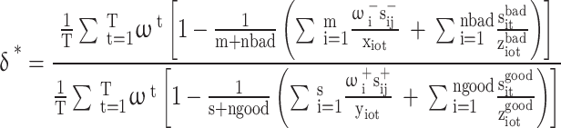
To mitigate the impact of multicollinearity on the regression outcomes, this study utilized Ucinet 6.0 software to conduct QAP regression analysis on the driving factors of the spatial association network of ACEE in Chinese cities for the years 2001, 2008, 2015, and 2022. The results of the QAP regression analysis are presented in Table 6. The regression coefficients of the total samples are all significant, indicating that the formation of the spatial correlation network of agricultural carbon emission efficiency is more favorable under the combined effect of nine types of control variables, namely the ADL, the AML, the IS, the GR, as well as the PFAL, the ND, the MM, and the CC.The intensity of network associations plays a critical role in enhancing a city’s influence on its neighboring regions, thereby facilitating the formation of the spatial association network of ACEE. Significant QAP regression coefficients for agricultural development level and industrial structure at various time points indicate that higher consistency in these variables among cities promotes the creation of these networks. According to geographic diffusion theory, cities at similar levels of development are more likely to link up and form ‘regional cooperation networks’ to promote the sharing and diffusion of low-carbon technologies, knowledge, and resources. This coherence reflects homogenized market structures and resource allocation environments and facilitates the synergistic sharing of technological advances, which in turn reduces carbon emissions and improves overall efficiency. The significant negative correlation observed in 2001 indicates that during the initial stages of mechanization, when agricultural mechanization technologies may not yet be fully developed and agricultural machinery relies on energy-intensive and inefficient energy sources such as fossil fuels, there is an increased likelihood of inefficient machinery use and potentially even an increase in energy consumption and carbon emissions due to improper operation. Consequently, agricultural mechanization does not provide immediate improvements in carbon emission efficiency in the short term. However, the significant positive correlation in 2022 suggests that mechanization levels will become more efficient in later years as technology advances and mechanization equipment improves, and more efficient energy sources and power trains (e.g. electric or hybrid machinery) are developed. This is consistent with the technology diffusion model (TDM), where advanced low-carbon technologies and more efficient machinery and equipment are widely used. On the policy front, the China Agricultural Modernisation Plan (2016–2020) and the Green Agricultural Development Action Plan further promote technology upgrading and the promotion of electrified and hybrid equipment, suggesting that mechanization up to a certain scale will ultimately become more efficient, underlining the importance of mechanization in modern agricultural practices. Between 2001 and 2022, the regression coefficients for industrial structure were consistently negative and significant. This indicates that while similar levels of industrial structure development among cities facilitate the formation of spatial association networks, improvements in industrial structure tend to lower overall ACEE, demonstrating an inhibitory effect. The process of industrial structure optimization is often accompanied by a shift of resources from low-carbon emission agriculture to more energy-intensive manufacturing and services, leading to an increase in overall carbon emissions. Although local governments have proposed to promote the low-carbon transformation of energy-consuming industries in the 13th Five-Year Plan, industrial transformation still leads to a certain amount of short-term carbon emission increase, which is in line with the ‘Short-term Cost of Industrial Upgrading’. This is in line with the ‘Short-term Cost of Industrial Upgrading’ (Short-term Cost of Industrial Upgrading). In 2015 and 2022, fertilizer application levels were significantly negatively correlated with ACEE. This suggests that increased fertilizer use suppresses efficiency, consistent with prior research highlighting the adverse environmental impacts of excessive fertilizer application. During the Twelfth and Thirteenth Five-Year Plans, although policies such as the Fertiliser Intensity Control Policy have advocated the reduction of fertilizer use and the promotion of green agricultural materials, the high cost of fertilizer reduction to farmers has made the policy difficult to implement. The over-reliance on chemical fertilizers to maintain high yields has not yet been fully curbed. According to the Ecological Modernisation Theory (EMT), the development of low-carbon agriculture must rely on the dual support of technological progress and policy guidance. Government regulation, however, showed significance only in 2008 at the 5% level, implying that variations in government scale among cities did not significantly influence the formation of the spatial association network of ACEE in Chinese cities.
Table 6.
Results of QAP regression analysis of ACEE drivers in Chinese cities.
| Independent variable | QAP regression coefficient | QAP regression analysis p-value | ||||||
|---|---|---|---|---|---|---|---|---|
| 2001 | 2008 | 2015 | 2022 | 2001 | 2008 | 2015 | 2022 | |
| Agricultural development level (ADL) | 0.031*** | 0.129*** | 0.340*** | 0.207*** | 0.001 | 0.008 | 0.001 | 0.003 |
| Agricultural mechanization level (AML) | − 0.017** | − 0.016 | 0.038 | 0.095** | 0.047 | 0.355 | 0.259 | 0.046 |
| Industrial structure (IS) | − 0.091** | − 0.190*** | − 0.142** | − 0.193*** | 0.017 | 0.011 | 0.042 | 0.001 |
| Government regulation (GR) | − 0.102* | − 0.166** | − 0.051 | − 0.067 | 0.084 | 0.015 | 0.223 | 0.124 |
| Pesticide and fertilizer application level (PFAL) | − 0.113 | − 0.044 | − 0.136*** | − 0.075* | 0.288 | 0.210 | 0.006 | 0.093 |
| Natural disaster (ND) | 0.214** | 0.109*** | 0.201** | 0.154** | 0.011 | 0.001 | 0.016 | 0.022 |
| Market mechanism (MM) | 0.191** | 0.202* | 0.255** | 0.038* | 0.045 | 0.077 | 0.023 | 0.069 |
| Climate change (CC) | 0.077** | 0.231 | 0.218* | 0.263 | 0.037 | 0.131 | 0.077 | 0.164 |
| Whole sample | 0.209** | 0.220** | 0.288** | 0.264*** | 0.025 | 0.041 | 0.013 | 0.000 |
The results of these analyses reveal the multiple roles of different variables in shaping the ACEE spatial linkage network. Consistency in the level of agricultural development and industrial structure strengthens inter-city linkages and contributes to technological synergy and carbon reduction. In contrast, the impact of the level of mechanization and fertilizer application varies over time, suggesting that their impact on carbon emission efficiency varies at different stages of development. In addition, the limited role of government regulation suggests the need for further optimization of policy interventions. Understanding the dynamic effects of these factors is crucial for the construction of a sustainable agricultural carbon emission policy system and provides a reference for future policy formulation. QAP regression analyses showed that natural disasters had a significant positive correlation on the spatial correlation network of agricultural carbon emission efficiency from 2000 to 2021. This indicates that natural disasters significantly affect the network structure of agricultural carbon emission efficiency among cities in different periods. Natural disasters may indirectly lead to greater variation in carbon emission efficiency among cities by affecting the stability of agricultural production, destroying infrastructure, and increasing the demand for carbon emission-related resources, as well as facilitating the reallocation of resources among cities, thus strengthening the spatial correlation among cities. The market mechanism shows a significant positive correlation in all years, especially in 2008, 2014, and 2022. This indicates that the improvement of the market mechanism can promote the flow of agricultural resources and the improvement of production efficiency, so that the efficiency of agricultural carbon emissions between different cities tends to develop synergistically. The market mechanism, through price signals, resource allocation, and market competition, can influence production methods and technology choices in agriculture, reduce ineffective carbon emissions, and make agricultural production more environmentally friendly and efficient. Therefore, increased marketization contributes to the formation and consolidation of the spatial correlation network of agricultural carbon emission efficiency. Climate change has a significant positive correlation on the spatial correlation network of agricultural carbon emission efficiency in 2008 and 2022. This indicates that climate change has a significant impact on the agricultural carbon emission efficiency network at different time points. Climate change may affect the carbon emission efficiency of agricultural production by altering precipitation patterns, temperature fluctuations, and the frequency of extreme weather events. Differences in adaptive capacity and responses to climate change across regions may lead to regional differences in carbon emission efficiency, exacerbating spatial correlations between cities.
Conclusions, discussion, and recommendations
Conclusions
This study employs the enhanced common frontier dynamic super-efficiency SBM model with undesirable outputs to evaluate the ACEE of 268 Chinese cities from 2001 to 2022. Following this, the structural characteristics of the spatial association network are examined using a modified gravity model and SNA. Furthermore, QAP regression analysis is conducted to identify the driving factors influencing the spatial association network. The results lead to the following conclusions:
Throughout the study period, ACEE of Chinese cities exhibits significant spatiotemporal heterogeneity. From a temporal perspective, ACEE demonstrated fluctuating trends during the study period from 2001 to 2022. Spatially, ACEE displays marked regional disparities and clustering characteristics. Central cities consistently maintain higher ACEE levels compared to their peripheral areas. Western regions generally exhibit superior efficiency levels relative to their eastern counterparts, while northeastern regions demonstrate moderate efficiency levels.
ACEE in Chinese cities was influenced by both neighboring regions and broader spatial connections, reflecting multidimensional, complex, and organic relationships. The analysis revealed fluctuating trends in network efficiency and density over the study period. The degree of centrality of the network initially decreased before increasing. The overall number of network connections also showed fluctuations throughout the examined period. These variations in network metrics indicate a relatively loose spatial association network among Chinese cities.
The ACEE network analysis revealed distinct patterns among different provinces. Guangdong, Sichuan, and Henan occupied dominant positions within the network. In contrast, remote provinces in the central and western regions, including Qinghai, Ningxia, and Yunnan, demonstrated lower degree and betweenness centrality. These provinces were found to be in peripheral positions within the ACEE network structure.
The network was divided into four blocks. The Northeast and Beijing-Tianjin-Hebei regions formed the “net beneficiary” block, occupying advantageous positions within the network. The southeastern coastal and southwestern regions were part of the “net spillover” block, holding disadvantaged positions. Spatial associations within blocks were sparse, while inter-block associations were tight, exhibiting significant spillover effects.
Variations in agricultural development levels and mechanization positively influenced the spatial association of ACEE in Chinese cities. In contrast, disparities in industrial structure and fertilizer application levels exerted a significant negative impact. Additionally, the level of government intervention played a relatively notable role in affecting the spatial association of ACEE.
Discussion
Enhancing ACEE is crucial for promoting high-quality, green, and sustainable agricultural development in China. This study constructs a spatial association network to analyze the spatiotemporal patterns and driving factors of ACEE in Chinese cities from 2001 to 2022. Unlike the DEA model used by Li et al.13. to measure the ACEE, this study utilizes an improved common frontier dynamic super-efficiency SBM model to measure ACEE, thereby providing a benchmark for assessing the intensity of agricultural carbon emissions at the city level and improving the accuracy of existing measurements. The main findings of this study, based on Tan et al.62, confirmed that agricultural development level, agricultural mechanization level, industrial structure, and fertilization level also have significant effects on ACEE spatial association network63. These research results laid a theoretical and practical foundation for the establishment of a collaborative urban carbon reduction mechanism and other related low-carbon practices by Zou et al.64. The results underscore the importance of targeted strategies to improve ACEE, ensuring that sustainable and efficient agricultural practices are adopted across diverse city regions in China. This comprehensive approach provides valuable insights for policymakers and stakeholders, aiding in the creation of effective measures to optimize ACEE and contribute to the broader goals of environmental sustainability and economic development. Due to the limited availability of data on influencing factors, this study focuses solely on the spatial association network structure and driving factors of ACEE at the city level. Future research could enhance the practical value of the findings by seeking alternative indicators from multiple dimensions and refining the analysis to the county level. In this study, the analysis of influencing factors is conducted using the QAP model, considering economic, industrial, governmental, and material input perspectives. Future research should incorporate a broader range of indicators and employ more complex models to explore their impact on ACEE, thereby increasing the study’s scientific rigor. Additionally, this study uses cities as the unit of analysis, which limits the refinement of the research perspective on spatial association intensity at the city scale. While the primary focus is on the ACEE of Chinese cities, the study lacks a targeted analysis of specific cities. Future research should concentrate more precisely on particular cities or major grain-producing regions, examining the relationship between agricultural industry development and carbon emissions within these areas and delineating their spatial association network structure.
Recommendations
Drawing from the research findings, the ensuing policy recommendations are suggested:
First, to address disparities in ACEE, it is essential to implement customized energy-saving and emission-reduction strategies. Cities must recognize their specific agricultural conditions, set clear low-carbon development goals, and learn from the successes of more efficient cities. Additionally, it is crucial to develop suitable green, low-carbon development models and strategies that align with local natural conditions and agricultural carbon emission profiles. Achieving these objectives requires enhanced cooperation and support, fostering coordinated development across cities. Moreover, emphasis should be placed on researching and disseminating key technologies to facilitate the collaborative improvement of ACEE in city areas.
Second, when formulating relevant policies, the government should prioritize enhancing the efficiency-related spatial connections between cities. It is essential to establish regional coordinated development and energy-saving carbon reduction mechanisms centered around cities with advanced ACEE. This strategy aims to reduce the efficiency disparities among various city areas. Concurrently, the government should leverage both market regulation and administrative measures to improve infrastructure, such as road transportation, thereby diminishing the spatial distances between cities. The creation of platforms for green, low-carbon environmental technology innovation and the establishment of multiple linkage channels will facilitate cross-city cooperation and exchanges. This strategy will enhance the connectivity and stability of the spatial network, ultimately leading to coordinated improvements in carbon emission efficiency.
Third, the developed eastern regions should boost financial investment in agricultural carbon reduction alongside the development of secondary and tertiary industries. Leveraging their geographic, financial, and technological advantages, these regions should actively promote low-carbon agricultural practices within their cities. Furthermore, they should enhance resource and element integration with central and western provinces, effectively dismantling regional barriers. This can be achieved through technology spillovers, ecological compensation, and targeted support, driving overall improvements in city ACEE. By doing so, the eastern regions can become powerhouses for promoting nationwide efficiency coordination, eliminating the obstacles of the “Matthew Effect,” and achieving spatially balanced efficiency development.
Fourth, the division of roles between sectors should be optimized and collaboration mechanisms should be strengthened in order to enhance carbon emission efficiency. In the “net-beneficiary” sector, it would be advantageous for relevant cities to augment their financial commitments to the research and development of low-carbon agricultural technologies. Furthermore, they should endeavor to facilitate the sharing of such technologies, with a particular emphasis on precision agriculture and resource recycling. This would serve to establish a benchmarking effect. Concurrently, a cross-regional low-carbon agricultural demonstration zone should be established to facilitate learning and imitation by cities in the “net spillover” segment. For cities in the “net spillover” segment, it is recommended that they focus on introducing the technological achievements of the “net beneficiary” segment. This can be achieved by accelerating the local low-carbon transition through specialized training and technology transfer, as well as providing financial incentives to encourage resource-saving agricultural production methods. As a result, synergistic upgrading between segments can be achieved through layered collaboration and technology diffusion.
Fifth, low-carbon development strategies should be formulated on the basis of the differentiation of driving factors, and factor flows and optimal resource allocation should be strengthened. In the context of policy formulation, the planning of low-carbonization paths should be undertaken in accordance with the specific local conditions, taking into account the level of agricultural development, the differences in industrial structure, and the varying degrees of mechanization across different cities. In cities with a high level of agriculture but a single industrial structure, it is recommended that the composite application of agricultural technologies be increased and that the combination of refined production and energy management be promoted. In cities where the excessive use of chemical fertilizers is a concern, it is essential to reinforce fertilization management techniques and encourage the utilization of bio-pesticides and green fertilizers. Furthermore, with regard to technological and financial inputs, it is advisable that central cities should be motivated to disseminate their low-carbon management expertise and facilities and equipment to peripheral cities, thus fostering collaboration among cities at all levels and gradually narrowing the efficiency gap between cities in the spatially connected network.
Author contributions
X.W. and B.C. wrote the main manuscript text. B.C. prepared all figures. All authors reviewed the manuscript.
Funding
This research was supported by Research Project on Philosophy and Social Sciences in Guangxi (Grant No.24JLB001). This study was funded by National Social Science Fund of China (Grant No.20&ZD157).
Data availability
The datasets generated and analyzed during the current study are available from the corresponding author on reasonable request.
Declarations
Competing interests
The authors declare no competing interests.
Footnotes
Publisher’s note
Springer Nature remains neutral with regard to jurisdictional claims in published maps and institutional affiliations.
References
- 1.Xia, Y., Guo, H., Xu, S. & Pan, C. Environmental Regulations and Agricultural Carbon Emissions Efficiency: Evidence from Rural China (Heliyon, 2024). [DOI] [PMC free article] [PubMed]
- 2.Iyke-Ofoedu, M. I. et al. Impact of CO2 emissions embodied in the agricultural sector on carbon sequestration in South Africa: The role of environmental taxes and technological innovation. J. Clean. Prod. 141210. (2024).
- 3.Najafi, A. et al. Medium-term energy hub management subject to electricity price and wind uncertainty. Appl. Energy. 168, 418–433 (2016). [Google Scholar]
- 4.Liang, X. & Li, X. Carbon emission causal discovery and multi-step forecasting for global cities. Cities148, 104881 (2024). [Google Scholar]
- 5.Wang, L., Zhang, M. & Song, Y. Research on the spatiotemporal evolution characteristics and driving factors of the spatial connection network of carbon emissions in China: New evidence from 260 cities. Energy291, 130448 (2024).
- 6.Liu, M. & Yang, L. Spatial Pattern of China’s Agricultural Carbon Emission Performance133, 108345 (Ecological Indicators, 2021).
- 7.IPCC.2006 IPCC. Guidelines for National Greenhouse Gas Inventory (2006).
- 8.IPCC.2019. Refinement to the 2006 IPCC Guidelines for National GreenhouseGas Inventory (2019).
- 9.Quadrelli, R. Peterson S.The energy–climate challenge:recent trends in CO2 emissions from fuel combustion. Energy Policy. 35(11). (2007).
- 10.Takeshi Kuramochi. Assessment of midterm CO2 emissions reduction potentialin the iron and steel industry:A case of Japan. J. Clean. Prod.32, 81–97 (2015). [Google Scholar]
- 11.Guo, X. et al. The impact of disposability characteristics on carbon efficiency from a potential emissions reduction perspective. J. Clean. Prod.408, 137180 (2023). [Google Scholar]
- 12.Le Quéré, C. et al. The global carbon budget 1959–2011. Earth Syst. Sci. Data. 5 (1), 165–185 (2013). [Google Scholar]
- 13.Li, X. et al. Using the carbon balance method based on fuel-weighted average concentrations to estimate emissions from household coal-fired heating stoves. Chemosphere307, 135639 (2022). [DOI] [PubMed] [Google Scholar]
- 14.Wang, K. et al. Resource abundance, industrial structure, and regional carbon emissions efficiency in China. Resour. Policy. 60, 203–214 (2019). [Google Scholar]
- 15.Xu, B. & Lin, B. Factors affecting carbon dioxide (CO2) emissions in China’s transport sector: a dynamic nonparametric additive regression model. J. Clean. Prod.101, 311–322 (2015). [Google Scholar]
- 16.Houghton, R. A. The annual net flux of carbon to the atmosphere from changes inland use 1850–1990. Tellus B Chem. Phys. Meteorol.51 (2), 298–313 (2016). [Google Scholar]
- 17.Dixon, R. K. C. Pools and flux of global forest ecosystems. Science263(5144), 185–190 (1994). [DOI] [PubMed]
- 18.Zou, J. Y. et al. Changes in fertilizer-induced direct N2O emissions from paddy fields during rice-growing season in China between 1950s and 1990s. Glob. Change Biol.15 (1), 229–242 (2010). [Google Scholar]
- 19.Cheng, K. et al. Carbon footprint of China’s crop production: an estimation using agro-statistics data over 1993–2007. Agric. Ecosyst. Environ.142, 231–237 (2011). [Google Scholar]
- 20.Johnson, J. M., Franzluebbers, A. J., Lachnicht Weyers, S. & Reicosky, D. C. Agricultural opportunities to mitigate greenhouse gas emissions. Environ. Pollut.150, 107–124 (2007). [DOI] [PubMed] [Google Scholar]
- 21.Tian, Y. & Yin, M. Re-evaluation of China’s agricultural carbon emissions: basic status, dynamic evolution and spatial spillover effects. Chin. Rural Econ.3, 104–127 (2022). [Google Scholar]
- 22.Cui, Y., Khan, S. U., Deng, Y. & Zhao, M. Regional difference decomposition and its spatiotemporal dynamic evolution of Chinese agricultural carbon emission: considering carbon sink effect. Environ. Sci. Pollut. Res.28, 38909–38928 (2021). [DOI] [PubMed] [Google Scholar]
- 23.Huo, T. et al. Spatial correlation network structure of China’s building carbon emissions and its driving factors: A social network analysis method. J. Environ. Manag.320, 115808 (2022). [DOI] [PubMed] [Google Scholar]
- 24.Hajime, A. et al. Distribution of SO2, NOx and CO2 emissions from fuel combustion and industrial activities in Asia with 1° (× 1° resolution. Atmos. Environ. (1994).
- 25.Rios, V. & Gianmoena, L. Convergence in CO2 emissions: A spatial economic analysis with cross-country interactions. Energy Econ. 75222–75238 (2018).
- 26.Fan, X., Wu, S. & Li, S. Spatial-temporal analysis of carbon emissions embodied in interprovincial trade and optimization strategies: A case study of Hebei, China. Energy. 185, 1235–1249 (2019). [Google Scholar]
- 27.Fang, X. et al. Spatial-temporal characteristics of the air quality in the GuangdongHong KongMacau Greater Bay Area of China during 2015–2017. Atmos. Environ.210(AUG.), 14–34 (2019).
- 28.Huang, H. et al. Evolution of spatial network structure for land-use carbon emissions and carbon balance zoning in Jiangxi Province: A social network analysis perspective. Ecol. Ind.158, 111508 (2024). [Google Scholar]
- 29.Lin, B. & Li, Z. Spatial analysis of mainland cities’ carbon emissions of and around Guangdong-Hong Kong-Macao Greater Bay area. Sustain. Cities Soc.61 (2020) (prepublish).
- 30.Zhi, L. et al. Spatially explicit carbon emissions at the county scale. Resour. Conserv. Recycl.173 (2021).
- 31.Jiang, Q. & Ma, X. Spillovers of environmental regulation on carbon emissions network. Technol. Forecast. Soc. Chang.169, 120825 (2021). [Google Scholar]
- 32.Hou, M., Cui, X., Xie, Y., Lu, W. & Xi, Z. Synergistic emission reduction effect of pollution and carbon in China’s agricultural sector: Regional differences, dominant factors, and their spatial-temporal heterogeneity. Environ. Impact Assess. Rev.106, 107543 (2024). [Google Scholar]
- 33.Du, Q. et al. Relationship of carbon emissions and economic growth in China’s construction industry. J. Clean. Prod.220, 99–109 (2019). [Google Scholar]
- 34.Yan, D. et al. Carbon emission efficiency and spatial clustering analyses in China’s thermal power industry: Evidence from the provincial level. J. Clean. Prod.156, 518–527 (2017). [Google Scholar]
- 35.Zheng, J. et al. Spatiotemporal analysis of CO2 emissions and emission reduction potential of Beijing buses using smart card data. Sustain. Cities Soc.99, 104976 (2023). [Google Scholar]
- 36.Kaya, Y. & Yokobori, K. ‘Global environment, energy, and economic development’ held at the United Nations University, Tokyo, 25–27 October 1993. ‘Global environment, energy, and economic development’held at the United Nations University, Tokyo, 25–27 October 1997 (1993).
- 37.Mielnik, O. & Goldemberg, J. Communication The evolution of the carbonization index in developing countries. Energy Policy. 27 (5), 307–308 (1999). [Google Scholar]
- 38.Sun, W. & Huang, C. How does urbanization affect carbon emission efficiency? Evidence from China. J. Clean. Prod.272, 122828 (2020). [Google Scholar]
- 39.Xie, Z., Wu, R. & Wang, S. How technological progress affects the carbon emission efficiency? Evidence from national panel quantile regression. J. Clean. Prod.307, 127133 (2021). [Google Scholar]
- 40.Zhu, R. et al. Temporospatial pattern of carbon emission efficiency of China’s energy-intensive industries and its policy implications. J. Clean. Prod.286, 125507 (2021). [Google Scholar]
- 41.Dong, F. et al. Regional carbon emission performance in China according to a stochastic frontier model. Renew. Sustain. Energy Rev.28, 525–530 (2013). [Google Scholar]
- 42.Zhao, P. et al. China’s transportation sector carbon dioxide emissions efficiency and its influencing factors based on the EBM DEA model with undesirable outputs and spatial Durbin model. Energy238, 121934 (2022). [Google Scholar]
- 43.Wei, X. & Ma, Q. Spatiotemporal effect and influencing factors of the total factor energy efficiency: Evidence from the urban agglomerations in China. Ecol. Ind.161, 111984 (2024). [Google Scholar]
- 44.Yang, X., Liu, Y., Bezama, A. & Thran, D. Agricultural carbon emission efficiency and agricultural practices: Implications for balancing carbon emissions reduction and agricultural productivity increment. Environ. Dev. 101004 (2024).
- 45.Liu, S. & Xiao, Q. An empirical analysis on spatial correlation investigation of industrial carbon emissions using SNA-ICE model. Energy224, 120183 (2021). [Google Scholar]
- 46.Chen, X. et al. Spatial correlation network of pollution and carbon emission reductions coupled with high-quality economic development in three Chinese urban agglomerations. Sustain. Cities Soc.94, 104552 (2023). [Google Scholar]
- 47.Zheng, X. et al. Review of the application of social network analysis (SNA) in construction project management research. Int. J. Project Manag.34 (7), 1214–1225 (2016). [Google Scholar]
- 48.Haicheng, X. Y. L. et al. Analysis of spatial associations in the energy–carbon emission efficiency of the transportation industry and its influencing factors: Evidence from China. Environ. Impact Assess. Rev.97 (2022).
- 49.Zhang, C., Fu, J. & Pu, Z. A study of the petroleum trade network of countries along The Belt and Road Initiative[J]. J. Clean. Prod.222, 593–605 (2019). [Google Scholar]
- 50.Alhaj, J. & Rrokne, J. Encyclopedia of Social Network Analysis and Mining (Springer Publishing Company, 2014).
- 51.He, Y. Y. et al. Spatial network analysis of carbon emissions from the electricity sector in China. J. Clean. Prod.262, 121193 (2020). [Google Scholar]
- 52.Shi, R., Shen, Y., Du, R., Yao, L. & Zhao, M. The impact of agricultural productive service on agricultural carbon efficiency—From urbanization development heterogeneity. Sci. Total Environ.906, 167604 (2024). [DOI] [PubMed]
- 53.Elahi, E., Zhu, M., Khalid, Z. & Wei, K. An empirical analysis of carbon emission efficiency in food production across the Yangtze River basin: Towards sustainable agricultural development and carbon neutrality. Agric. Syst.. 218, 103994 (2024).
- 54.Zhang, N., Sun, F. & Hu, Y. Carbon emission efficiency of land use in urban agglomerations of Yangtze River Economic Belt, China: Based on three-stage SBM-DEA model. Ecol. Indic.160, 111922 (2024).
- 55.Wu, Y., Li, K. & Fu, X. An integrated zero-sum game and data envelopment analysis model for efficiency analysis and regional carbon emission allocation. Decis. Anal. J.10, 100387 (2024).
- 56.Ni, G. et al. Spatial differences, dynamic evolution and influencing factors of China’s construction industry carbon emission efficiency. J. Clean. Prod. 141593 (2024).
- 57.Xueqiang, J., Huimin, L. & Yuesong, Z. Spatiotemporal evolution and driving factors of spatial correlation network structure of China’s land-use carbon emission. Econ. Geogr.43 (2), 190–200 (2023). [Google Scholar]
- 58.Xu, H. et al. Analysis of spatial associations in the energy–carbon emission efficiency of the transportation industry and its influencing factors: Evidence from China. Environ. Impact Assess. Rev.97, 106905 (2022). [Google Scholar]
- 59.TIAN, C. S. & Chen, Y. China’s provincial agricultural carbon emissions measurement and low carbonization level evaluation: Based on the application of derivative indicators and TOPSIS. J. Nat. Resour.36 (2), 395–410 (2021). [Google Scholar]
- 60.Erda, F. S. L. The challenges and opportunities of China’s agricultural greenhouse gas emission trading. Adv. Clim. Change Res.8 (1), 54 (2012). [Google Scholar]
- 61.Panmao, Z. et al. Research progress in impact of 1.5℃ global warming on global and regional scales. Adv. Clim. Change Res.13 (5), 465 (2017). [Google Scholar]
- 62.TAN, R. & LIU, H. Characteristic evolution and influencing factors of the spatial correlation network of agricultural green total factor productivity in China. Chin. J. Eco-Agric.30 (12), 2011–2022 (2022). [Google Scholar]
- 63.Yun, Z. & Jie, H. A Study on the characteristics and driving factors of spatial correlation network of agricultural ecological efficiency in China (2021).
- 64.Zou, Y. & Huang, M. Carbon emissions in urban agglomerations: feature mining, formation mechanism and peak intervention. J. Beijing Inst. Technol. (Social Sci. Ed.). 25 (6), 56–67 (2023). [Google Scholar]
Associated Data
This section collects any data citations, data availability statements, or supplementary materials included in this article.
Data Availability Statement
The datasets generated and analyzed during the current study are available from the corresponding author on reasonable request.