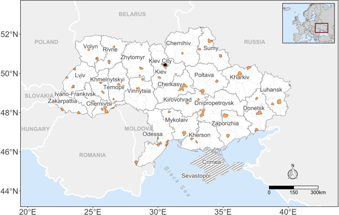
Fig. 1.
Map of the study region highlighting the selected areas of interest (AOI) in orange within each Oblast. An “oblast” in Ukraine is the main type of first-level administrative division, equivalent in hierarchy, though not in absolute size, to states in the US context. The gray-dashed area depicts the occupied territories of Crimea and Sevastopol, both excluded from the current study. This map was created using R software v.4.3.

