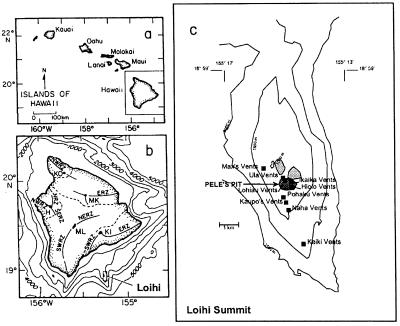
FIG. 1.
(a) Hawaiian Islands, showing location of the island of Hawaii. (b) Location of Loihi Seamount relative to the island of Hawaii and its five volcanic shields. (c) Summit bathymetry of Loihi Seamount, showing location of observed hydrothermal vents. Pele's Pit formed during the 1996 eruption. Depths are in meters. Shaded areas indicate the summit pit craters.

