
Figure 1.
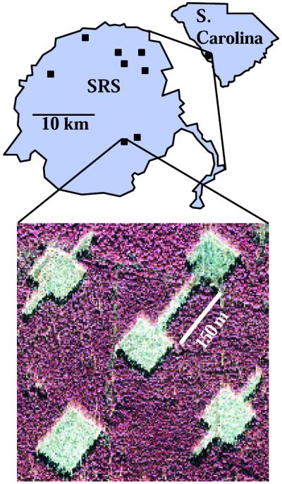
Map of experimental landscape locations and aerial photograph of one landscape, showing patch configuration. Each of the eight landscapes (squares) consists of five early-successional patches surrounded by mature coniferous forest (see Methods). In each landscape, the central patch (1 ha) is connected to one peripheral patch by a 25 × 150-m corridor. The other three peripheral patches in each landscape are equal in distance from the central patch, and equal in area to the connected patch plus the area of the corridor (1.375 ha). In each landscape, one unconnected patch is winged, one is rectangular, and the third is either winged (four landscapes) or rectangular (four landscapes).