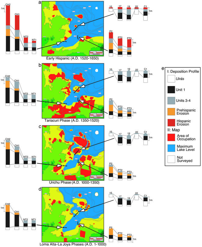
Figure 3.
The coevolution of landscape and settlement by major archaeological phases. (a–d) Interplay of lake level, settlement, and lithostratigraphic unit that characterizes landscape development within the study region. The three catenas depicted (Insets) are, clockwise from top right: Copujo, Pareo, and Charahuén. (e I) Color indicating lithostratigraphic units. Central portion is a map of the study area; (II) color indicating settlement and lake level.

