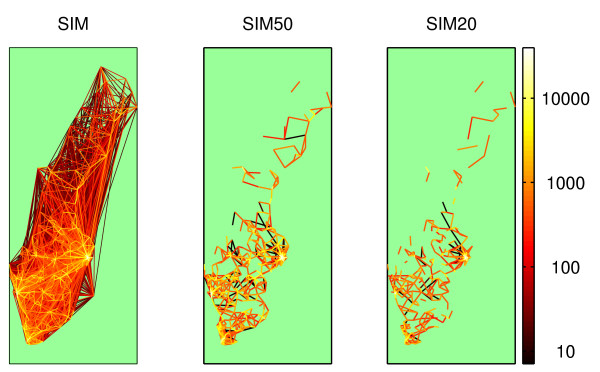
Figure 1.
The intermunicipal travel network. The intermunicipal travel network with travel intensities indicated by color lines. The scale is logarithmic in trips per day. SIM shows the complete dataset. In SIM50 and SIM20, all journeys > 50 km and 20 km, respectively, have been removed. The lines are drawn between the population centers of each municipality, so in many cases the trips are shorter than the lines representing them.

