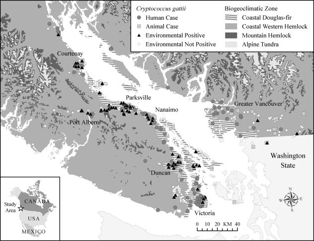
FIG. 2.
Map of Vancouver Island, the Gulf Islands, the lower mainland of British Columbia, and northern Washington state, showing the distribution of reported human and animal cases up to December 2005 as well as that of sampling sites from which positive and nonpositive environmental samples were obtained between October 2002 and January 2006.

