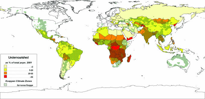
Fig. 1.
World map showing the links between undernutrition and hydro-climatic preconditions. Prevalence of undernourished in developing countries is shown at the country level as the percentage of population 2001–2002. Hydro-climatic distribution of semiarid and dry-subhumid regions are shown in gray. These regions correspond to savanna and steppe agro-ecosystems, dominated by sedentary farming and subject to extreme rainfall variability and high occurrence of dry spells and droughts.

