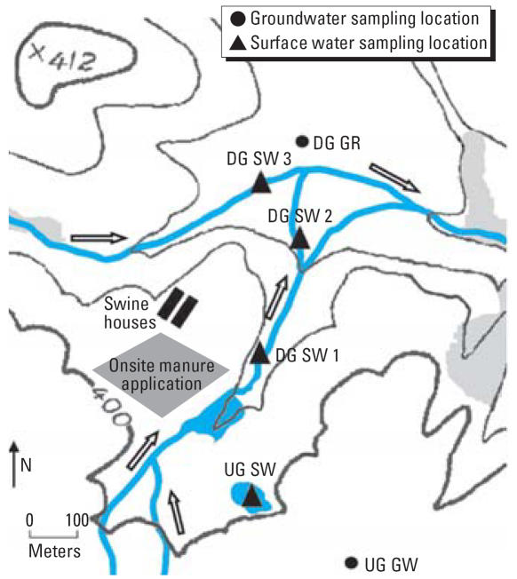
Figure 1.
Map of study site and sampling locations. Abbreviations: DG GR, down-gradient groundwater sampling location; DG SW 1, first down-gradient surface water sampling location; DG SW 2, second down-gradient surface water sampling location; DG SW 3, third down-gradient surface water sampling location; UG GW, up-gradient groundwater sampling location; UG SW, up-gradient surface water sampling location. Topographic contour lines are given in feet, and contour intervals = 20 vertical ft. Arrows indicate the direction of surface water flow. Topographic data were obtained from a U.S. Geological Survey map of the study area (U.S. Geological Survey 2006).

