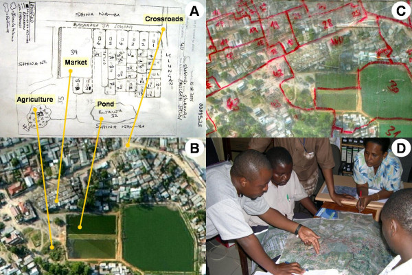
Figure 3.
Example of a sketch map, aerial picture and technical map. A. Sketch map of TCU 40 in Kurasini ward, Shimo la Udongo neighbourhood, as drawn by the responsible CORP. Features comprise plots with continuous numbering, streets, drains, agricultural areas and ponds. B. The same area on the aerial picture. The yellow lines are connecting identical features on the sketch maps and the aerial picture. C. The same area on the laminated aerial photograph used for the technical mapping in the field. The features to be mapped were marked with non-permanent marker pens. Red: TCU boundaries and TCU numbers. D. Project management team discussing over the technical map of a whole ward, and deciding on necessary follow-up actions.

