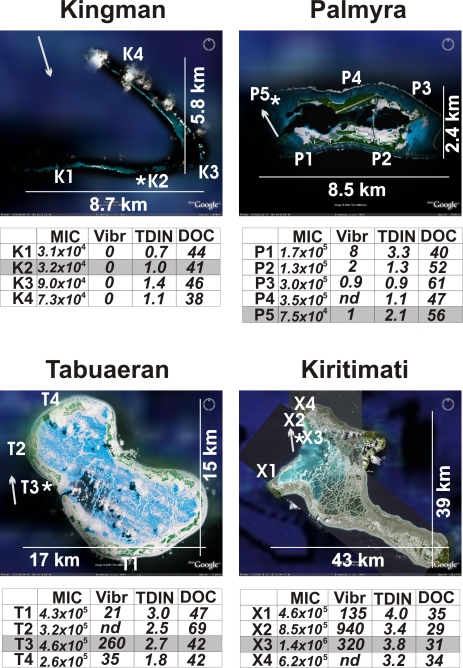
Figure 1. Maps of the sites surveyed on the four Northern Line Island atolls.
The locations for the water chemistry, microbe/viral direct counts, and Vibrio spp. culturing are indicated with the first letter of the atoll name (X for Kiritimati sites) and sequentially numbered. The sites for the metagenomes are labeled with an *. Coral cover, fish counts, and other macro-organism data were sampled at all of these sites, as well as additional sites [18]. The prevailing current is shown as a grey arrow. MIC = number of microbes per ml; Vibr = number of culturable Vibrio spp. on TCBS plates per ml; DOC = dissolved organic carbon in µM; TDIN = total dissolved inorganic nitrogen in µM (nitrite and nitrate, and ammonium). Maps were taken from Google Earth.

