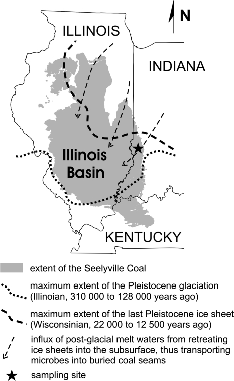
FIG. 1.
Map showing the extent of the Seelyville Coal formation in the Illinois Basin. The sampling site is located in the eastern marginal zone of the basin. The dotted and dashed lines represent the southernmost extents of the most recent Pleistocene glaciations. The arrows indicate the inferred direction of melt water influxes during inter- and postglacial periods.

