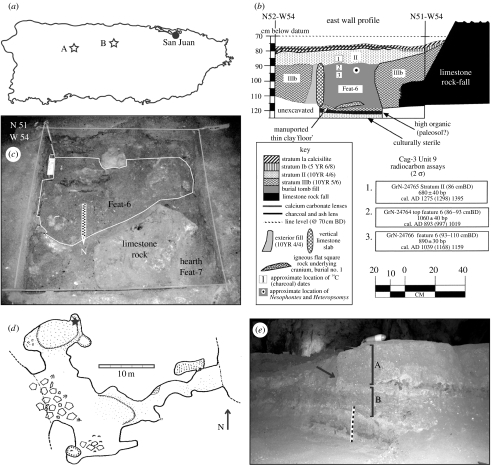
Figure 2.
(a) Map of Puerto Rico, showing locations of Cag-3 (A) and Cueva del Perro (B). (b) Cag-3 tomb fill stratigraphic profile, showing locations of dated samples and charcoal dates. (c) Cag-3 tomb fill. (d) Cueva del Perro plan view. Quadrat location indicated by star. (e) Cueva del Perro section, showing stratigraphic layers and quadrat location. (b) and (c) after Oliver & Narganes Storde (2005); (d) after McFarlane (1999).

