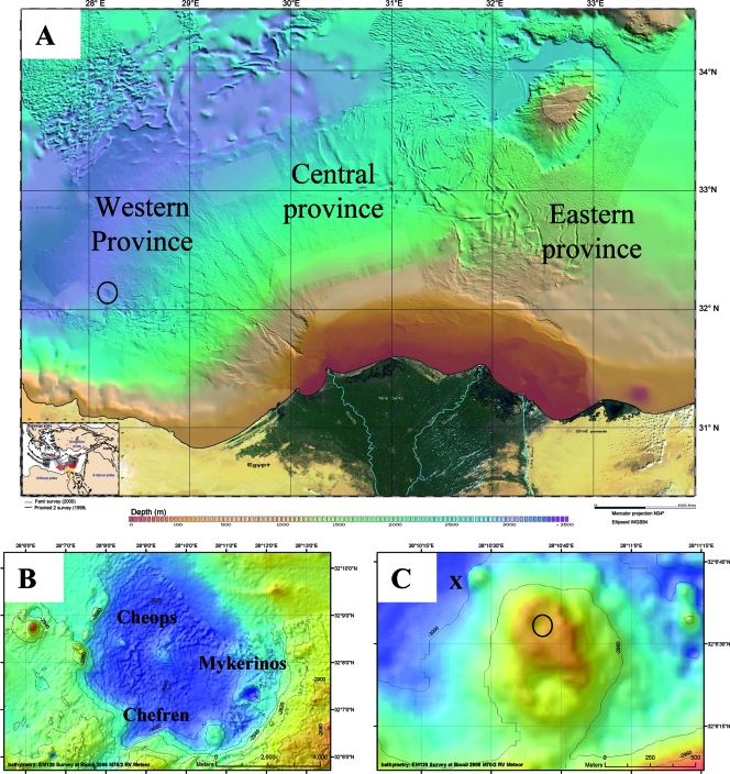
FIG. 1.
(A) Bathymetric map of the Nile Deep Sea Fan. The circle indicates the position of the Menes Caldera. (Adapted from reference 47 with permission of Geosciences Azur/CIESM.) (B) Bathymetric map of the Menes Caldera with its three mud volcano systems. (C) Bathymetric map of the Chefren mud volcano. “X” indicates the location close to Chefren characterized by orange and white mats, and the circle indicates the location where brine samples were obtained during Nautile dive 18. The maps in panels B and C were obtained during METEOR expedition BIONIL M70/2 in 2006 using the EM120 multibeam.

