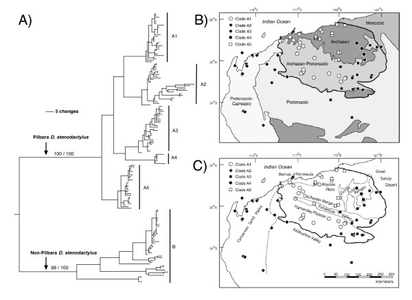
Figure 2.
(A) Summary of phylogenetic results of the fine-scale ND2+tRNA data set of Lucasium stenodactylum showing the distribution of major clades in the Pilbara. Values refer to unweighted parsimony bootstraps and Bayesian posterior probabilities, respectively, of the major clades (see electronic supplementary materials for full details). (B) Simplified geological basement map of the Pilbara and surrounding regions. The geology adapted from the 1978 BMR Geological Map of Australia. The lines indicate boundaries between rock sequences of different ages, and the heaviest weighted line defines the boundary of the Pilbara Craton; (C) Outline map at same scale as (B) showing important topographic features such as sand plains, valleys, plateaus and ranges – modified from Beard (1969) and improved with space-borne altimetry. The dashed line is the 200 m contour drawn where the boundary between sand plains and elevated ground eastwards is prominent.

