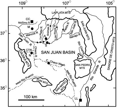
Fig. 1.
Site location map for the San Juan Basin. CC, Crow Canyon; LL, Los Lunas; M, Mesa Verde; A, Aztec Ruin; S, Salmon Ruin; N, Newcomb; C, Chaco Canyon; CTW, Captain Tom Wash. ♦, Sample sites in San Juan River drainage (also see Fig. 4, which is published as supporting information on the PNAS web site, www.pnas.org). Dashed lines indicate ephemeral stream drainages.

