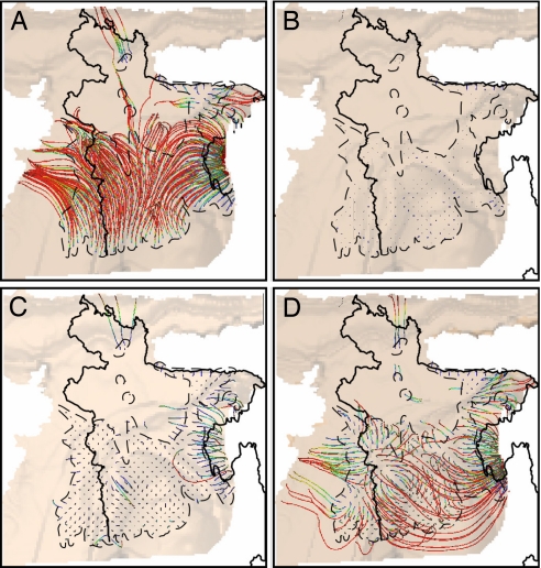
Fig. 2.
Groundwater flow paths for base-case simulations to locations at depths of 175 m for predevelopment scenario (A), 30 m for current shallow pumping situation (B), 175 m for deep pumping alternative (C), and 175 m for split pumping alternative (D). Black line is Bangladesh border. Colors represent travel times: red indicates longest times (6,000+ years). Flow lines with short lateral travel distances appear as specks.

