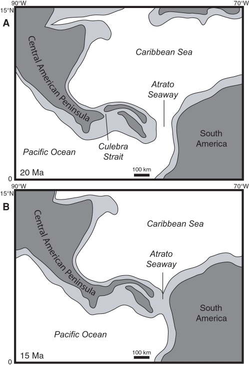
Figure 11. Paleogeographic reconstructions of Central America for (A) 20 Ma and (B) 15 Ma.
Light gray represents the outline of tectonic plates containing continental or volcanic-arc crust. Dark gray represents subaerial land. Base maps for the reconstructions were derived from the ODSN Plate Tectonic Reconstruction Service (http://www.odsn.de/odsn/services/paleomap/paleomap.html). The location of subaerial land is based on this study and the distribution of Cretaceous to Tertiary continental and volcanic terranes as derived from Case and Holcombe [70].

