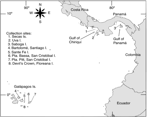
Fig. 3.
Map of the ETP indicating location of reefs sampled. Numbers denote reefs at (1) Secas Island (7° 57′18′ ′N; 82° 00′45′ ′W), (2) Uva Island (7° 48′48′ ′N; 81° 45′32“W), (3) Saboga Island (8° 37′43′ ′N; 79° 03′26′ ′W), (4) Bartolomé, Santiago Island (0° 17′17′ ′ S; 90° 33′15′ ′W), (5) Sante Fe Island (0° 48′17′ ′S; 90° 2′20′ ′W), (6) Punta Bassa (0° 49′N; 89° 32′W), (7) Pta. Pitt (0° 42′30′ ′S; 89° 15′W), San Cristóbal Island, and (8) Devil's Crown, Floreana Island (1° 12′5′ ′S; 90° 25′23′ ′W).

