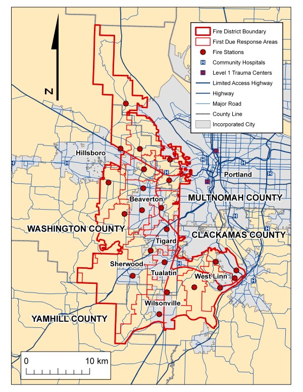
Figure 1.
Study area: Tualatin Valley Fire & Rescue District (TVF&R). This map shows the boundary of the fire district, the major cities, county boundaries, fire station locations and their respective first-due response areas, the major highway and street system, and the location of community hospitals and the two pediatric trauma centers.

