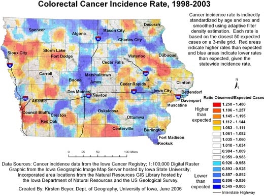
Figure 2.
Example of map and explanatory information to illustrate the spatial pattern of colorectal cancer incidence, mapped using adaptive spatial filtering, Iowa, 1998-2003. Data sources: Cancer incidence data from the Iowa Cancer Registry; 1:100,000 digital raster graphic from the Iowa Geographic Image Map Server hosted by Iowa State University; incorporated area locations from the Natural Resources GIS Library hosted by the Iowa Department of Natural Resources and the US Geological Survey.