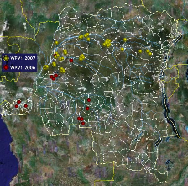
Figure 1.
Mapping wild polio virus cases in DRC. The 40 cases of wild polio virus identified in DRC from January to December 2007 are depicted here. Cases seemed to follow the course of the Congo River. Since polio cases in the polio surveillance database are not geocoded, coordinates (Latitude and Longitude) of districts of residence of cases were extracted from the GeoNet name database and used as a proxy for case location on the map. Markers are custom Portable Network Graphics (PNG) images designed with Macromedia Fireworks™. Disclaimer: The map is intended solely to demonstrate the use of Google Earth™ in public health mapping. Any other intended use will be inappropriate. Refer to authoritative sources (World Health Organization) for polio eradication information.

