
Figure 2.
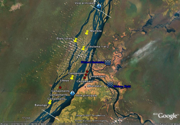
Google Earth for public health mapping. Google Earth allowed us to get maps of acceptable resolution to help elaborate the micro plan and guide operations on the field. This Google Map image of a portion of the Congo River around Mbandaka shows the main islands (yellow pins), known temporary (seasonal) settlements (read dots) and main navigation routes. The upper and lower white lines show the limits of district areas of responsibility.