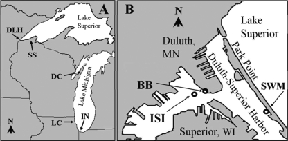
FIG. 1.
Maps of study areas, showing sampling site locations. (A) Map of Lakes Superior and Michigan, showing sites in the Duluth-Superior harbor, Lake Superior (DLH); the south shore of Lake Superior (SS); Door County, WI, Lake Michigan (DC); Lake County, IL, Lake Michigan (LC); and Indiana, Lake Michigan (IN). (B) Map of Duluth-Superior harbor, showing the locations of Interstate Island (ISI), the Blatnik Bridge site (BB), and the Southworth Marsh site (SWM).

