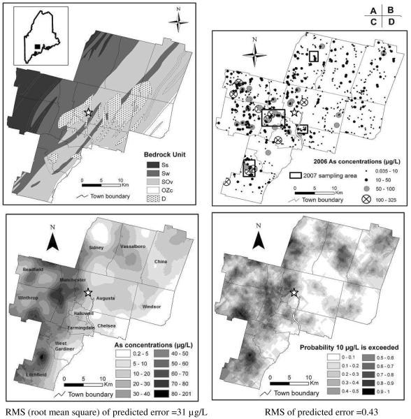
Figure 1. Bedrock geology and groundwater As distribution in the greater Augusta, Maine area.
The star symbol in all panels indicates downtown Augusta.
A. Simplified bedrock geology. See text for description of the bedrock units. Insert is a map of Maine with rectangle representing the study area.
B. Discrete groundwater As distribution based on 2006 sampling. The rectangles indicate the four clusters sampled at greater density in 2007.
C. Log-normal kriged groundwater [As] distribution.
D. Probability of groundwater [As] >10μg/L by indicator kriging.

