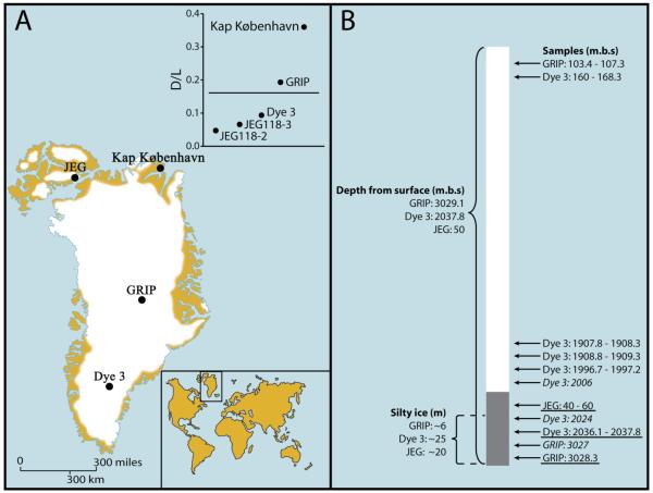
Fig. 1.
Sample location and core schematics. (A) Map showing the locations of the Dye 3 (65°11′N, 45°50′W) and GRIP (72°34′N, 37°37′W) drilling sites and the Kap København Formation (82° 22′ N, W21°14′ W) in Greenland as well as the John Evans Glacier (JEG; 79°49′ N, 74°30′ W) on Ellesmere Island (Canada). The insert shows the ratio of D to L aspartic acid, a measure of the extent of protein degradation; more highly degraded samples (above the line) failed to yield amplifiable DNA. (B) Schematic drawing of ice core/icecap cross-section, with depth (in meters below surface, m.b.s.) indicating the depth of the cores and the positions of the Dye 3, GRIP, and JEG samples analyzed for DNA, DNA/amino acid racemization/luminescence (underlined), and 10Be / 36Cl (italic, the control GRIP samples are not shown). The lengths (in meters) of the silty sections are also shown.

