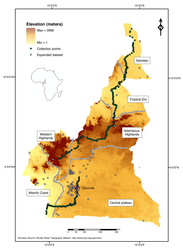
Figure 1.
Map of Cameroon with sampled localities. Topographic map of Cameroon showing elevation (from buff = low-altitude to dark brown = high-altitude). Dotted lines delimit biogeographic domains as defined in the Methods from [47]. Dark dots indicate the 305 villages that were sampled during the North-to-South transect carried out in Aug-Dec 2005; clear dots represent additional collection points (expanded dataset for the ENFA analysis, see text).

