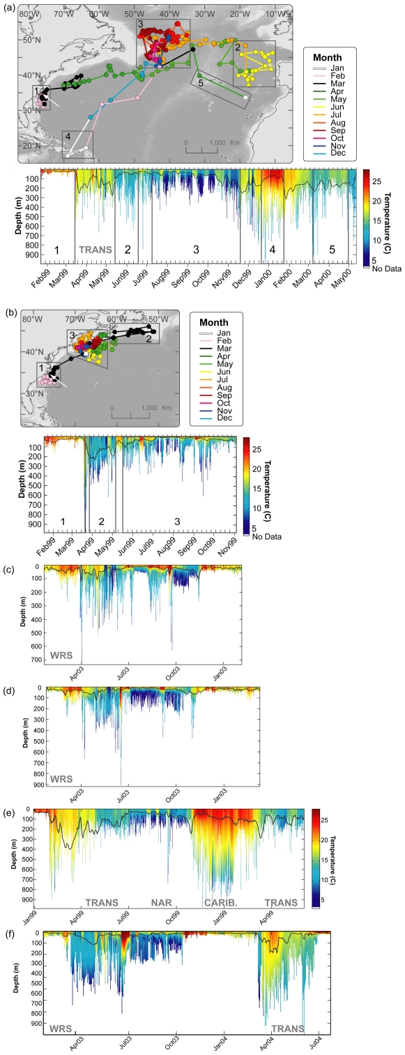
Figure 10. (a)–(b) Monthly geolocation estimates and track of individual Atlantic bluefin tuna with corresponding depth and temperature profiles indicating maximum diving behavior in relation to water temperature.
Black boxes indicate geographic regions covered by profiles. White arrow indicates deployment location. Black line in depth/temperature profiles indicates estimated depth of thermocline. (a) Bluefin in North Atlantic resident migration (98–485). Section 1: North Carolina, 2: off offshore Iberian Peninsula, 3: in North Western Corner, 4: northern Caribbean, 5: East Atlantic passing through Azores. (b) Bluefin in western resident migration (98–508). Section 1: North Carolina, 2: south off New Foundland & Novia Scotia, 3: offshore New England, Gulf of Maine, Fundian Channel and then Georges Bank. (c)–(f) Examples of depth/temperature profiles of fish in various migration phases. (c) & (d) WRS (744 & 1021); (e) TRANS and North Atlantic residency (98–504); (f) WRS & TRANS (1016) with entry into the Mediterranean Sea in July.

